nuxx.net
Making, baking, and (un-)breaking things in Southeast Michigan.

Category mapping

Flat Tire

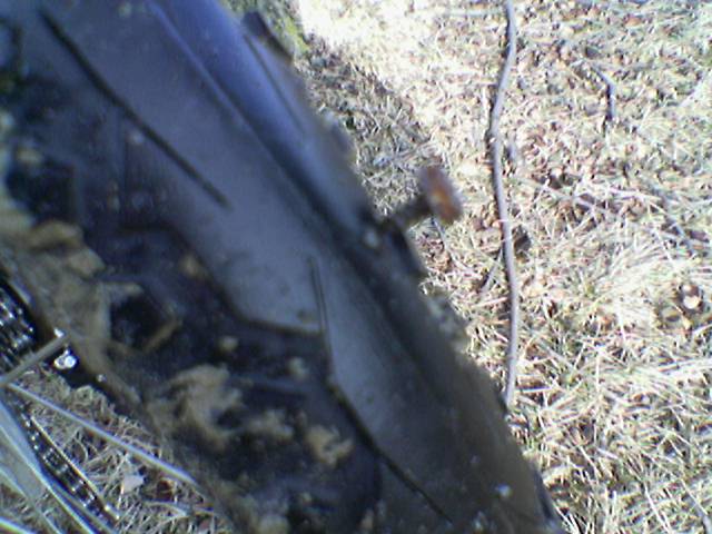
Yesterday I decided to see if I could easily get near the Lakeside / shopping area via bike, with as little riding in roads as possible. This worked out well, except while riding along a small connector road which runs behind Meijer and Costco and whatnot, I got a flat. It was a sheet metal screw stuck nicely into the thin part of the new tires. Uggh.

It wasn’t particularly hard to change the tube, it was just a bit dirtier and colder than I would have liked. The area near there is still under construction, so there was a bit of water and mud that I had just gone through. It was also just above freezing, so the tire was really stiff and took a bit of effort to get back on to the rim. Oh, and the Blackburn Shorty pump took quite a while to get to get the tires actually full enough to ride on.

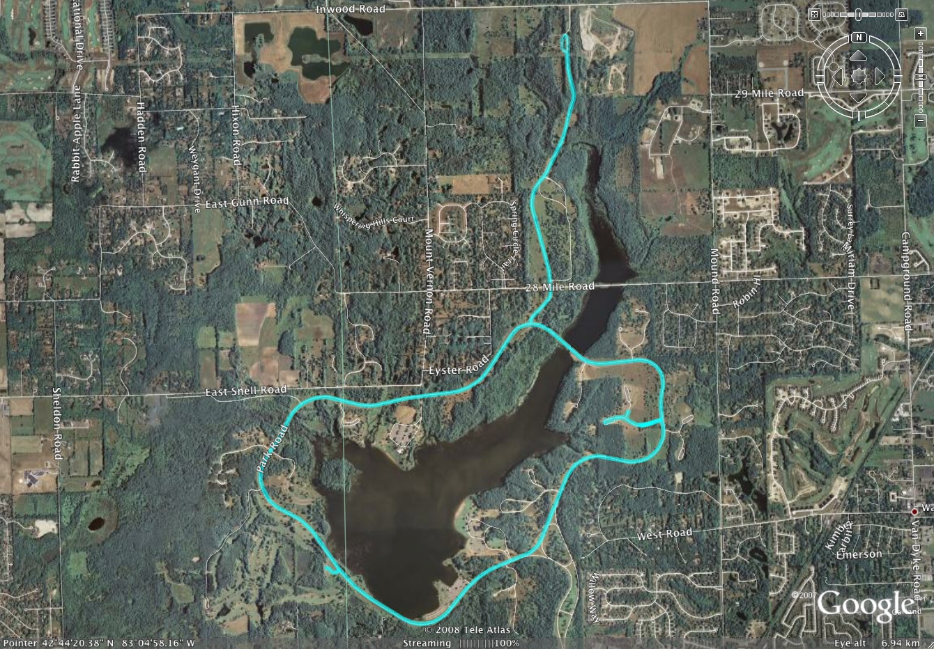
Ah well. At least it got sorted out. If you are interested, here is the route I took, with start and flat tire points marked, and here is the KMZ itself.

Oh, and those tires? They do great on the pavement, in snow, in a bit of mud where there was no sidewalk, and on grass. I’m pretty happy with them.

cyclingmappingmoved from livejournal

GPS + Bike Stuff

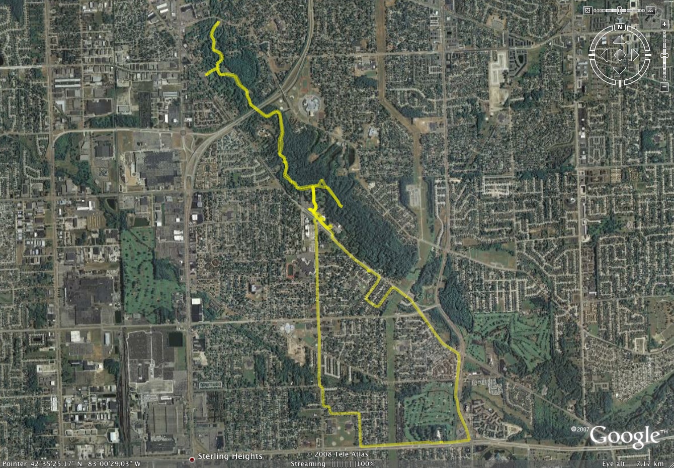
Google Earth Plot of my Bike Ride
(Click for full res image…)

That right there is a plot of the bike ride I went on yesterday. Yes, it won’t make much sense for those of you who don’t know the northern Sterling Heights / Utica / Clinton Township area, but it’s a ~12 mile round trip.

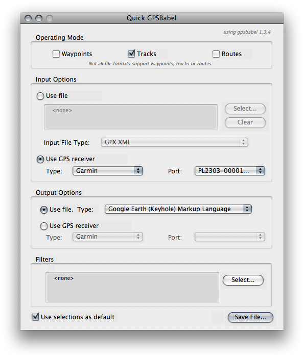
If you’re wondering how this is made, I simply had my old Garmin eTrex Legend GPS mounted on the handlebar of my bike, logging the route as I rode. Then today I connected it to my Mac via a serial cable and USB adapter, fired up the Mac OS X version of GPSBabel+, set the input to the USB serial port, type Garmin GPS, selected to transfer only Tracks, and set the output to ‘Google Earth (Keyhole) Markup Language’, or KML file. Then I just opened the file in Google Earth, edited it a bit, deleted the points and left only the track, and saved it off as a new KMZ. Here is a screenshot of GPSBabel+ set up the way I use it for transferring data from my GPS to a KML file.

Note that when using the GPSBabel+, if I select Waypoints, Tracks, and Routes I only get Waypoints. If I select just Tracks, I get the data used for this plot. If I select just Routes, GPSbabel (or the crappy USB adapter, or something) hangs, with a process I can’t kill, even with -9. (This is why I suspect it’s the crappy USB adapter or its driver.). Also note that GPSBabel+ is a OS X GUI for the gpsbabel command line utility.

If you’d like to poke with the data for the map, and open it in Google Earth (or whatever) yourself, grab 15-Mar-08_dodge_park.kmz.

This link opens the file in Google Maps for you, with street names and such.

cyclingmappingmoved from livejournal

VG’s Bike Rack

So, the note I sent to VG’s yesterday? I got a response this afternoon, and it’s good:

Dear Mr. Vigneau....

Thank you for your email. Your request is an excellent one. It seems that in the scramble to get the store open, we missed installing a bike rack. I have ordered one and it should arrive at the store within the next week or so. We'll get it installed as soon as it arrives. We look forward to having you shop at the store and thank you again for the great suggestion.

Have a good weekend!

Regards....

Bill Ogle
VG's Food Center

phone 810.629.xxxx
fax 866.706.xxxx

This is excellent. Here is the route from my house to there, and as you can see, it’s pretty darn short. Very, very bikable. I will be avoiding riding in Schoenherr, as it is a 50MPH road with no shoulders (only curbs) and loads of people driving really, really horrible. (If you know this area, you know the sort… it’s >60% SUVs and trucks, swerving around the people making turns, with ~20% of drivers talking on cell phones.)

But, anyway, yeah. This is good!

Today Danielle and I did a bunch of running around as well. I ended up getting a rack for the back of my bike, the Explorer w/ disc brake mounts. I was going to get a smallish bag for holding the small, necessary bits, but instead I think I’ll get the RX Trunk Bag EX instead. It’s only about $10 more than a small underseat bag and should provide plenty of room for lunch or whatever.

Then again, there’s always the possibility of folding grocery bag holders

UPDATE: Oooh! This, a basket which clips right into the rack I just installed, is $25.80 via Amazon. I think that’ll do. That should hold a hand-held basket full of groceries, which is exactly the quantity I normally buy when going shopping. Yay!

cyclingmappingmoved from livejournal

Smooooooth Rider

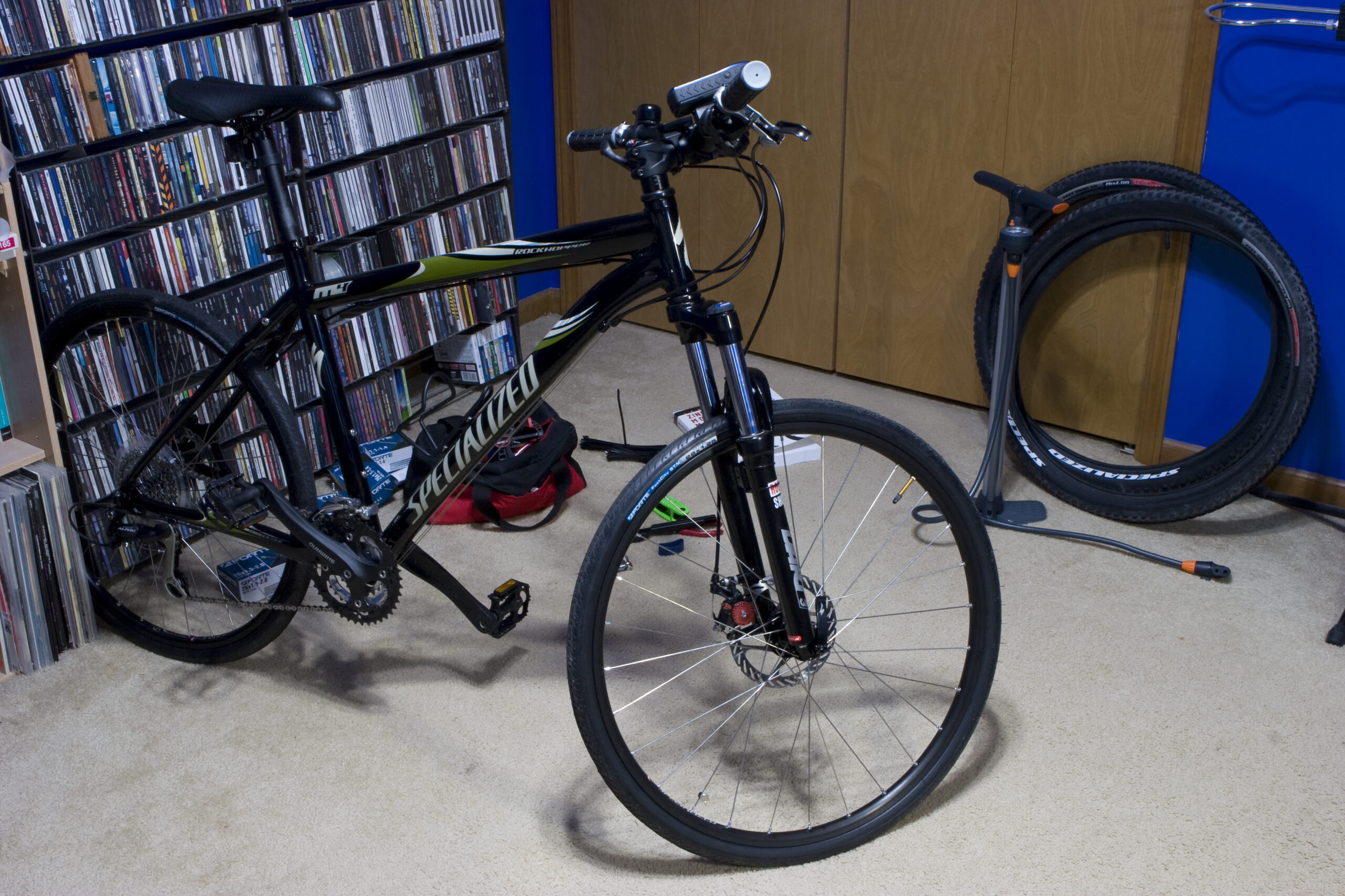
Specialized 2008 Rockhopper Disc w/ Forte FastCity ST/K TiresSpecialized 2008 Rockhopper Disc w/ Forte FastCity ST/K Tires
(Click for bigger image…)

Two more of the packages of bike stuff I’ve been waiting for arrived today, bearing the GPS mount, smooth tires (Forte FastCity ST/K), tubes (yes, including the wrong ones with Presta valves), Crank Brothers tool, tube patching kit, tire tool, and stuff like that.

With Zinn and the Art of Mountain Bike Maintenance arriving yesterday, I’d started giving it a read. It’s pretty good, although a bit more basic than I need. As the book says in the beginning, it’s really for someone who isn’t comfortable doing mechanical work yet and wants all the basics. Still, it’s nice to see the in depth descriptions of how certain bits of a bike are to be taken apart, info on lubricating and cleaning bits, exploded views of things, stuff like that. Oh, and the author’s nifty bits of amusing advice and warnings are good too.

I read through the section on installing tires (only three pages), then went ahead and put the new tires on my bike. They are some smooth road-ish tires which a friend of mine rather likes. Putting the new tires and tubes on was easier than I expected. Removing the rear wheel was a bit of a problem, as I either don’t know a good trick for getting the rear quick release around the derailer, or it really is just difficult. Regardless, it got done.

After the tires (and GPS mount) were fitted I decided to go for a test ride around the neighborhood, to see how the tires, GPS, and things like that all work out. The first thing I noticed was that the tires work great. At ~70psi things were nice and smooth, exactly how I wanted it to be on pavement. The tires have a maximum of 90psi or so, so this is well within a safe range. I would have liked to have gone farther, but I don’t have lights yet, so riding in public wouldn’t be legal. The neighborhood here also has streets and is relatively cut off, so I figured it was a good, safe area for playing around and trying out braking and such.

Next I noticed that the GPS kept crashing, leaving a single column of pixels on the screen, and the bike computer wasn’t registering revolutions. Some side of the road poking around showed that the GPS’ backlight interferes with the wireless bike computer. This shouldn’t be a problem, as I’ll rarely be using the backlight anyway, but it is a bit annoying. I also need to determine if the bike computer was somehow causing the GPS to crash. I had recently upgraded the firmware on the GPS and thrown some new (2008) maps into it so that could somehow be related, but… I’m not sure. I’ll have to poke with it more and see.

While riding around, the bike computer clocked a maximum speed of 23.7MPH, but as these bike tires are a bit smaller than the knobby ones, I think that may have been about 10% off. Still, I’m pretty happy with how much faster I was able to ride. After three (fast, for me) laps around my neighborhood I was pretty cold, which is to be expected when wearing a nice flow-through helmet and having no hair.

Either way, I’m pretty happy. I just have to wait for the bike frame pump to arrive and then I can figure out what bag to get, and maybe go riding some this weekend. If the weather holds out it’ll still be reasonably warm, and as long as the trails haven’t acquired more snow / ice, I’ll try and hit up some of the local paved trails and see how things go.

cyclingmappingmoved from livejournal

Trails

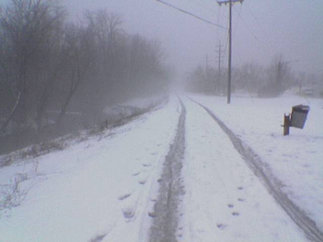
That right there shows why I couldn’t bike any trails in Rochester today. The Clinton River trail there was covered in around 3″ of slush and snow, making pedaling nearly impossible. So, I ended up riding from the parking lot just off of Letica Drive up to Parkdale, back down, around the eastern side of downtown Rochester for a while, up Letica Drive to Parkdale, down Parkdale to a little ways before Dequinder, then back.

It was foggy / misty from the warm air and cold, damp snow, but this was a bit pleasant. I do think that I may need fenders for my bike, though… There’s a good bit of wetness on the back of my jacket, and I had to periodically stop and clean off my glasses.

While it wasn’t very far, the hills in that area, the bits of snow that were still on the pavement, and the giant (1′ high, 3′ wide) banks of snow at each crosswalk made going a bit slow. I went a total of 5.76 miles, averaged 8.5 MPH, with a recorded maximum of 25.4 MPH (down a hill along Parkdale).

I imagine that once there isn’t snow on the ground and I have smoother tires, those numbers will change considerably. Also, I’ll be able to easily ride on dirt trails and whatnot too, once they aren’t coated with ice.

After returning home Danielle and I went for a ride around the neighborhood then down to a yet-to-be-completed (after ~3 years) neighborhood just down 22 Mile, closer to Hayes. Being on flat ground this was considerably more leisurely, covering 2.6 miles and averaging 7.3 MPH. Basically, we were riding around and just talking and stuff.

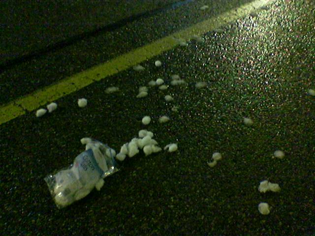
Also, here is a photo of cotton balls spilled in the parking lot of Meijer.

cyclingmappingmoved from livejournal

With gas prices on the rise, I figured I should top off my tank tonight. I bet they’ll jump tomorrow… Almost US$20 later, I had ~7.5 gallons of mid-grade gas. Uggh.

En route to the gas station, I decided to use the car’s trip meter to clock the distance I just ran. Well, it came up with 0.6 miles. Hmm. I swore it was longer than that last year when I walked it with a GPS. So, when I got back to my house I re-ran it with the GPS in my back pocket.

Unfortunately the GPS doesn’t work so well in my pocket, so it only logged a few scattered points and 0.6 miles. I guess I’ll just have to walk it again tomorrow, GPS held high in the air (or at least out in front of me) to establish the true distance.

Regardless, I ran the loop around my neighborhood non-stop again.

I’m satisfied. I think now I deserve a beer.

healthmappingmoved from livejournal

Mmm… Toxic!

Last night and I went wandering a rather interesting local park. This is Walden Ponds in Shelby Township, MI, which is located on part of the old G & H Landfill, which was a Superfund site. The restoration work is now done, and the wetlands have been turned into a Heron Rookery. There’s also an interesting trail which leads out the back of the park and eventually to Yates Cider Mill at 23 Mile and Dequinder. Oh, and you can’t forget the rather forboding water treatment plant which sits off to the side of the park, quietly cleaning up the filth.

Of course, we can’t forget an obligatory satellite photo of the site, complements of ‘s wonderful mapper.ofdoom. Set the format to Metro and the zoom to 0.5m/p for a good view of the site. This starts centered on the pond in front of the plant.

mappingmoved from livejournaloutdoors

Does anyone who reads my journal have any experience doing GIS work? I need to make a map of Mackinac Island for this week. I think the maps are available from the state for free in electronic format, I’m just having trouble figuring out where to go from there.

mappingmoved from livejournal