New Trail Map of Bald Mountain Recreation Area – North Unit
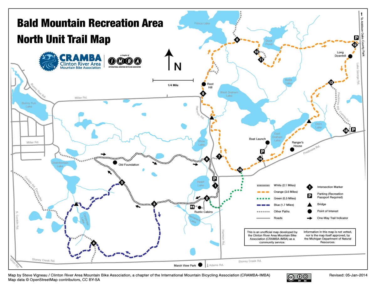
This morning I’d originally planned on going for a ride in the currently-active snowstorm, but I started working on a project that I’d wanted to complete for a while, and this evening I completed it: a CRAMBA-IMBA map of Bald Mountain Recreation Area – North Unit. Home to some gently rolling, old-style trails built with cross country skiing in mind it’s not very challenging, but this is one of my favorite mountain bike trails in the area.
Over the last few slow speed wintertime rides there I’d collected the GPS data I was lacking, put it into OpenStreetMap today, cleaned up the existing data, and followed my mapping workflow to create this map. It has a fair bit more detail than the official park map, showing some of the unofficial but well used connector trails, colloquial names for some areas, and a bit more context. It’s what I personally would want for a mountain bike centric map of the trail.
So, what to map next… I’d like to do a CRAMBA-IMBA map of Pontiac Lake Recreation Area, but I’ll need to spend more time riding and exploring there before that’s feasible. I’m familiar with the trails, but not familiar enough with the park to do a proper map. I also want to update the Bloomer Park map to get something that better matches the style of the other maps. But, for now, I’m glad that this got done. I feel like I’ve accomplished something.
One can see this map overlaid on Google Maps, along everything else in the MMBA Trail Guide here: link.