Press "Enter" to skip to content

Category: travel

Help Please: 2022 AIDS/LifeCycle Fundraising

Years ago Mark Ferlatte told me about the AIDS/LifeCycle (Wikipedia) charity ride from San Francisco to Los Angeles to raise money for the San Francisco AIDS Foundation and the Los Angeles LGBT Center. Money raised by this event allows the two non-profits to provide free HIV/AIDS medical care, testing, and prevention services. Each rider in the event raises at least $3000, with the event raising over $220,000,000 since it began in 1993.

At 545 miles over seven days, riding everywhere from the Pacific Coast Highway to proper California mountains, this sounded like it a wonderfully fun way to see a new part of the country, really enjoy being outside, and most importantly raise money to directly help save lives. But, it always seemed like such a logistical challenge that fell into the back of my mind as a one-day-in-the-future goal.

Well, here we are, and 2022 is the year!

This year Kristen and I are both signed up for the 2022 AIDS/LifeCycle ride! On June 5th we will set out from Cow Palace in San Francisco to spend the next week pedaling through one of the most beautiful parts of the country with a couple thousand other folks, all of us with one goal: helping those with HIV/AIDS.

This is where we need your help. Specifically, we need money.

Kristen and I each are working to raise least $3000 through donations from people like you. We all give money to trails, trail organizations, and other groups which help make our lives more fun and enjoyable. Please join us in also giving a bit more to save lives, so everyone can have a great life.

Please click one of these links to donate: SteveKristen

(Donations are to a non-profit, and thus tax deductible.)

Thank you for your help, and for making the lives of those with HIV/AIDS better!

Comments closed

Suggested First Rides in Marquette

Here’s a quick list of easy to follow mountain bike routes in the Marquette area, as Trailforks routes. Fun, accessible routes friendly to all bike types, from rigid fatbikes to squishy trail bikes, perfect for getting you started riding in the Marquette area. Each loop will take most riders an hour to and hour-and-a-half each, excluding stops, and are excellent on their own or as a basis for exploring other trails.

These trails are all built and maintained by the Noquemanon Trails Network and are constantly being improved and expanded. Without their work you wouldn’t have these great trails to ride, and without donations they can’t exist. Click here to send some money their way to keep these trails great. (Sign up for a full NTN membership here.)

Keep in mind all these trails are two way and quite popular in both directions. Be nice, say hi, yield appropriately, and let others know how many more folks are behind you.

NTN North Trails (from BLP Trailhead)

Kristen’s Favorite Loop: One of the best ways to get started with riding North Trails. An easier route than the South Trails, but by no means boring, this route includes views of the awesome Forestville Dam and Falls, Wright Street Falls, Forestville Basin, the penstock (large wood pipe). Climbing is gradual but sustained, as are the descents, with just enough rock sprinkled in to make things fun.

NTN South Trails (from South Trailhead)

Green / Morgan Creek Loop (Clockwise): Perfect intro to the South Trails, with rolling climbs and descents, riding past and over waterfalls. Scatterings of rocks and roots are all over, but nothing difficult; the perfect everything trail. Follow the green signs.

Red / Pioneer Loop (Clockwise): Begins with the Benson Grade Access Road climb, then starts with a relatively flat but slightly rocky single track before snaking it’s way along a beautiful brook and mildly rocky trails along with views of Lake Superior. A bit more technical than Green, but another great trail to get started on. Follow the red signs.

Gorge-ous to Blue: A step above the Red and Green loops, this heads downhill on the incredibly scenic Gorge-ous trail (part of the Yellow route) and loops back to the trailhead using portions of the Blue loop. Gorge-ous is mostly smooth dirt, with a handful of rocks and roots, and some decent (for Michigan) exposure. Blue, the oldest route in the system, is considerably rougher and has some challenging climbs, but is still a lot of fun. Starts by following Grom (Purple Signs) to Gorge-ous (Yellow Signs) and then continues on Forget-Me-Not (Blue Signs) after reaching the Carp River.

(If you want more information, check out my longer post, Marquette Mountain Biking for Trolls, which gives downstate Michigan folks pointers on getting started riding in the Marquette area.)

Comments closed

2018 Marji Gesick 100: #QUITTER

IMG_6420.jpg

After successfully finishing the Marji Gesick 50 in 2017 I got a strange desire to do it again, but this time trying the 100 mile option. Most of my difficulties with MG50 were due to the heat, dehydration, and not being sufficiently familiar with technical trail riding. Having completed Lumberjack 100 numerous times, finished the Barry-Roubaix Psycho-Killer, and done a bunch of not-easy 100+ mile gravel rides I’m no stranger to completing ultra endurance events, and I figured that with the right preparation I’d be able to finish.

From great fat biking to a solid Lumberjack, from long endurance rides to getting a smart trainer, preparation worked out really well this year. I was fortunate to be able to spent a lot of time up in the Marquette area riding bikes, getting plenty of experience with technical sections (both up and down) that I was previously too afraid to ride. I got a lot of climbing in, did a number of long rides, had a solid nutrition plan, had the requisite lighting set up, and was ready to go.

Unfortunately, it didn’t work out. I DNF’d. Why? Fatigue.

And I just didn’t have it in me.

The course wore me out. Whether you are doing it as a race or just to finish, Marji Gesick 100 is a serious event, awarding a beautiful belt buckle to anyone who crosses the finish line in under 12 hours. With only a bit over 12 hours of daylight on race day, and buckles typically only going to elite-level racers, most normal humans (such as myself) who manage to finish will be in for a long day with the most technical of the riding — the end of the route — happening in darkness. I definitely underestimated the toll the first part of the race would take on me. Before starting I roughly figured race day would take ~15 hours, and with the low heart rate I tend to have on these technical routes (compared to long pre-race rides), I thought that I’d be fine. With my longest rides of the last three years being 9-10 hours moving time, about half way through the route I realized I hadn’t had enough long days. As the day wore on and I hit ~11 hours I was feeling pretty cooked.  The first time I reached the bag drop† I was feeling spent, but decided to go back out and see how I felt; clear lenses in my glasses and lights in my pack I kept riding.

While I could still put out power, as I got into the very-technical RAMBA trails I was feeling sleepy and a little light headed at the top of climbs. I didn’t have the focus to climb nor descend well, feeling like I was constantly about to make mistakes, walking much more than the last time on those trails. My upper body was getting sore from handling the bike and I stopped having fun. I kept riding, telling myself that when I reached the Iron Ore Heritage Trail (IOHT) as the course passes through Ishpeming I’d decide what to do.

While I probably could have finished, I stopped half-way up the switchback climbs of Last Bluff, looking out at the setting sun, and decided my day was over. Three miles later, where Partridge Knob splits off from the IOHT I stopped my Garmin, put on arm warmers, chatted with some support folks on an ATV, and texted Kristen to let her know I’d be meeting her in 20 minutes.

This was a real good day, and I had a lot of fun for the amount of race route that I did ride. To some extent I think I could possibly have finished, but I don’t think it would have been any fun, and I really didn’t feel like trying. Getting those remaining 20-some miles done would have involved hours of walking in the dark and not riding what’s otherwise super-fun trail. I don’t regret my decision, and even as I quit I was looking forward to coming back and having fun with the MG50 in 2019.

Two days later I ended up back out on the RAMBA trails, starting a ride from where I dropped out of the race. GPS data, memories of last year, and a few lingering signs pointing the way I finished up the race course and realized two things:

  1. I really, really like these trails.
  2. The choice to DNF was the correct one.

So, beyond quitting? It was a great race, and I’m really glad I did it. But I really do think the MG50 is more for me.

Here’s some data on Strava of my race day and the finishing-it-up ride:

My remaining thoughts about the race are best captured as points:

  • Having someone to meet you and help you out with nutrition (the only kind of outside aid you’re allowed to accept) is amazing. Kristen met me at the South Trailhead with a half a burrito and mixed up bottle. Seeing her, eating that burrito, and only having to worry about filling my pack with water was mentally amazing and hugely helpful.
  • Starting off the MG100 is a 0.5 mile run. I was worried this would cause me problems, but I sort of trotted / jogged along and it was fine. Running along with my friend Erik and chatting it sort of just went, and next thing I knew I was at the start area and my bike and it was time to ride.
  • The weather was intimidating at first, but otherwise amazing. It was in the 40s at the start, but most of the day hovered nicely in the 50s and 60s. I mostly had a chilly/cool feeling on my arms, but never felt cold.
  • The route is mostly great. Starting out heading into Harlow Lake strings things out nicely, and by the time we reach the first seriously technical section (Top Of The World) things are fairly spread out.
  • There were two not-very-hard parts of Harlow Lake that I did not enjoy riding, especially in a group. The first was the Lower Hogback single track, which is rocky and wet. The second was the swampy portion through the power line corridor when heading south. The latter soaked my feet, and they remained wet until I changed socks at the bag drop lots of hours later. I’m glad I had good socks.
  • It was clear climbing the back side of Marquette Mountain was going to be tough, but I figured we’d be taking the usual double track to the top. Instead we turned off of the double track and climbed Snake Oil before descending Ezy-Rider. That climb, and seeing only 51 miles on my computer when I reached the top, was when I started to question if I could finish.
  • The mix of folks I ended up near on the MG100 seemed to be a bit more serious / less talkative than those I rode with last year in the MG50. I’ll chalk this up to nerves and lots of people taking the race more seriously than I apparently did.
  • While difficult, the whole route remains great. There’s a good number of parts I can’t yet ride (Gurly, some climbs, a fair number of things in RAMBA-land), but otherwise it’s outstanding.
  • After climbing Lowe’s the race route passes through a box culvert. I was afraid this would be full of water, but no… it was fine. It was just dark. There are far swampier areas within a few miles of the end of the race.
  • There were many, many ad hoc aid stations. At almost every major road crossing or parking area there were folks set up. Beyond what Kristen got me, I also ate a couple granola bars, a banana, and some water. At almost every significant point there was someone offering food, water, and even whisky and beer. These aid stations are MUCH less frequent around the RAMBA trails.

If you are trying to decide if you should try this race, do it. You will need to prepare, those who haven’t ridden in the UP should plan a trip or two to get a sense of the trails before race day, but do it. When registration opens at 12:01am on October 13th, sign up. Consider doing the MG50 as it’s a good bit easier than the full MG100, but do it. It’s worth it. These are phenomenal trails in an amazingly beautiful area. You will struggle and suffer a bit, but you will have fun doing it. And you’ll want to come back again and again.


† While the race is officially unsupported, it passes through a bag drop area at Jackson Mine Park — a de facto aid station — twice. Once around 70 miles in, and a second time at around 95 miles.

‡ The MG100 race is officially 100 miles, most riders who complete it with a wheel sensor see ~110 miles total. I believe the higher number to be correct, based on:

  1. Recording 59 miles for last year’s MG50.
  2. Seeing 51 miles on my bike computer when the 50 and 100 courses converged.
  3. My experience with assessing under recording on GPS-only vs. GPS-and-wheel-sensor setups.
  4. Detailed analysis of the official GPX route files compared to my recordings of the same trails.
2 Comments

Marquette Mountain Biking for Trolls

This article was originally published in 2016 for downstate Michigan folks who are heading to Marquette to ride, but after two years of trips to the UP with Kristen and seeing more and more trails developed, this article has been updated for the 2018 summer riding season. Originally a handful of suggestions — shared via email or chats or talking over beer — it all has been written down, consolidated, and made available for everyone.  Even if you aren’t from Michigan, the recommendations below are a great way to get accustomed to cross-country mountain biking (XC MTB) in and around Marquette County.

Please know that this is not intended to be a thorough overview of all trails in the area, but instead recommendations from a Lower Peninsula rider’s perspective for how those new to the Marquette area can get started riding comfortably on fun and challenging trails, without getting in over one’s head too quickly. The greater Marquette area offers a huge range of mountain biking, with routes that anyone who is comfortable riding in Southeast or Southwest Michigan (eg: Stony Creek, Potowatomi, Pontiac Lake, Fort Custer, Yankee Springs) can thoroughly enjoy.

When first arriving in Marquette it’s highly recommended to visit one of the many great local shops (eg: Sports Rack, Down Wind Sports, Lakeshore Bike, Quick Stop) and pick up the official trail maps. Older versions of these are available as PDFs on the Marquette Township Documents website (under Recreation CommitteeRecreation Maps), but they lack some of the newer trails, and it’s a really good idea to have an up-to-date copy in your pocket until you are familiar with the trails. The South Trails have maps at most intersections, but the (slightly easier to memorize) North Trails do not. These shops are all great, have treated me well, and are perfect for both route suggestions and parts or repairs.

For those of us from lower Michigan, we’re pretty accustomed to one-way trails. In the UP the trails are all two-way, unless marked otherwise (typically only downhill trails). When I first rode two-way trails I was a bit worried about how it’d go, but in practice it’s not a problem. Trails in and around Marquette are much lower traffic than those downstate, and tend to be a little wider with better sight lines. Same as one does for hikers, keep an eye out for other riders, keep to one side or stop and let them by (downhill riders yield to those climbing) and all works out well. When passing by others, tell the other person/people if you are riding alone, how many more there are behind you, if you are last, etc. (eg: “just me”, “two more”, “last one”.) Others will do the same, and this’ll lets everyone know what to expect.

Another notable change from downstate trails is difficulty and consistency. I find that many of our downstate trails are of easy to moderate difficulty, but will occasionally have surprise, sudden transitions mid-trail. Sharp, off-camber turns or blown-out rooty downhills after a fast, flowing section prompt me to ride slower than needed until I know a trail. Trails in the Marquette area tend to be more consistent with far fewer of these abrupt surprises. While they are overall more difficult, the consistency, flow, and lack of surprise features makes a first-time ride on them feel very welcoming.

In the Marquette area there are effectively four different systems of trails, South Trails, North Trails, RAMBA Trails, and Harlow Lake area. Here’s my take on each:

South Trails

Overview: Located just south of downtown, these are generally seen as the main Marquette trails and are the most popular riding in the area. The main trailhead off of M-553 (Google Maps) is where the widely-photographed trailhead sign, picnic, and changing areas are at. A huge range of trails start here; this is a great place to begin. (These trails are built and maintained by the NTN.)

Where to Start: Start with the Purple-signed Grom Loop. Yes, the kids trail. It’s a great warmup, and a fun ride to get a glimpse of the rolling terrain in the area; comparable in difficulty to Addison Oaks. Next ride either Green (Morgan Creek Loop) or Red (Pioneer Loop) clockwise. Access these by following the signs and crossing M-553. Green clockwise begins immediately across the road on your left, Red requires a climb up Benson Grade (the gravel two track) and then begins straight ahead. Ride down the two track at the top of the hill for 100′ or so and then veer left on to the trail if you don’t want to ride across the top of the pipe.

Green is pretty smooth, with some twisty turns, good ups and downs, and the trail takes you over the top of a waterfall (Morgan Creek Falls). Red starts out with a bit of rock and roots and has some (signed) optional tech lines, but then gets smoother and more flowing, particularly as you enter the Greywalls golf course area. Two good routes that mix up Green and Red and make for some fun riding are:

South Trailhead → Climb Benson Grade → 9 (via Red) → 10 (via Red) → 11 (via Green) → South Trailhead (via Green)

South Trailhead → 11 (via Green / Carp Eh Diem) → 10 (via Green) → 5 (via Red) → 7 (via Red) → 6 (via Red) → 8 (via Red) → South Trailhead (via Red)

Near the end of Red, before getting back to the trailhead, you’ll find yourself back at M-553. Cross, turn right on the sidewalk, and a few hundred feet later at the top of a rise look for a trail sign on your left. Enter the woods here and ride this section (known as Mossy) and you’ll pop back out at a road. Cross at the crosswalk and continue south along M-553 for a short while longer and you’ll be back at the trailhead.

After riding Red and Green, for more of a typical UP feeling with rocks, roots, and exposure, take Yellow (Gorgeous) east from the trailhead down to the Cliffs Power Road trailhead, the Blue back to the main trailhead. This section has a good bit more climbing and is a lot harder than Red or Green, but is still fun. Just before returning to the trailhead on Blue there is a split labeled More Difficult and Less Difficult. This choice is in relation to the very last section ridden, and the More Difficult section has chunkier rock than anywhere in SE Michigan; it’s quite a sight to see. This route is as follows, but has a few unmarked intersections. Just go straight, following the more-worn groove:

South Trailhead → 17 (via Grom) → 18 (via Gorgeous) → 13 → 15 → 16 → South Trailhead

Finally, be sure to climb Benson Grade again and ride Down Dogger and Eh Line. Down Dogger is a flow trail that’s completely rollable with only a bit of rock. Keep speed in check and anyone comfortable riding fast on twisty SE MI single track will have a blast. Eh Line is a jump line that begs to be ridden fast and getting air, but is completely rollable. Part-way up Benson Grade you’ll cross Eh Line, indicated by a large set of rocks on your right. I personally am more fond of Down Dogger, as it’s a bit more rough trail and less jumpy, although there’s still plenty of places to get in the air. Both of these trails are just to the left at the top of Benson Grade, with Eh Line before the pipe and Down Dogger just over. We have no trails like these in Southeast Michigan.

Don’t be afraid to go explore; trails here really aren’t as remote as they may seem when riding. They almost all cross two track at some point, and many adjoin neighborhoods. You won’t become truly lost. Anything labeled as Black Diamond (Very Difficult) should be doable to an experienced rider from SE Michigan, but will be a step (or three) beyond what is found downstate.

The only section I would suggest avoiding at first is the climb from 18 to 19 into Marquette Mountain Ski Area. It’s a fairly uninspiring climb, and finding one’s way through the ski area and back down can be a bit confusing. This is being built out to make a big yellow loop that connects with Pipe Dreams and Off Grade, but as of early 2018 it’s not done. Currently it can be a fun ride, but isn’t as good as other parts of the South Trails.

There are many other trails in the South Trails area, including very-technical and drop-filled freeride / downhill trails. Before venturing into an unknown trail be sure to note the difficulty designation. Sticking to the main colored loops (Red, Green, Blue, Yellow) will keep to the XC trails and avoid any real surprises.

North Trails

Overview: Often overlooked or dismissed as too-easy, located on the north side of town, across the lake from the popular Tourist Park campground, and continuing northwest to the NTN’s Forestville Trailhead. Typically more mellow and smoother than the South Trails, but with some truly beautiful views and fun riding. (Built and maintained by the NTN.)

Where To Start: For an easy start, I suggest starting at Tourist Park Trailhead (Google Maps) and exploring to the west, sticking to the single track. This is milder climbing and far less technical riding than most routes on the South Trails, but still a lot of fun, and a good way to get a feel for riding in the area. Some of my favorite sections are the climb to (and descent from) the Blue Heron Overlook, Collinsville Cut, The Oxbow, and portions of EZ-PZ which run directly along the river.

Once you have a feel for the North Trails, consider riding out to the Forestville Trailhead and back, making a loop. You can do this starting at Tourist Park Trailhead, or start in the middle of the North Trails at the Marquette Board of Light and Power (BLP) trailhead located just west of 2200 Wright St.. Here’s a great route from the BLP Trailhead to Forestville Trailhead and back:

BLP Trailhead → Dead River Trail (West) → Collinsville Cut (West) → BLP Rocks (under the penstock) → Lower Falls View → Blue Heron (turn left / climb up the hill) → Blue Heron Connector → At the end, cross the train tracks to your right → up Ramblin’ Man (to your left after the tracks) → Forestville Trailhead (water on the left side of the shed)  → down Ramblin’ Man → Blue Heron Connector (cross the tracks again, ride for a few hundred feet) → Silver Lead (cross an old road bridge in the middle, trail continues on your left) → Collinsville Cut → Dead River Trail (East) → BLP Trailhead

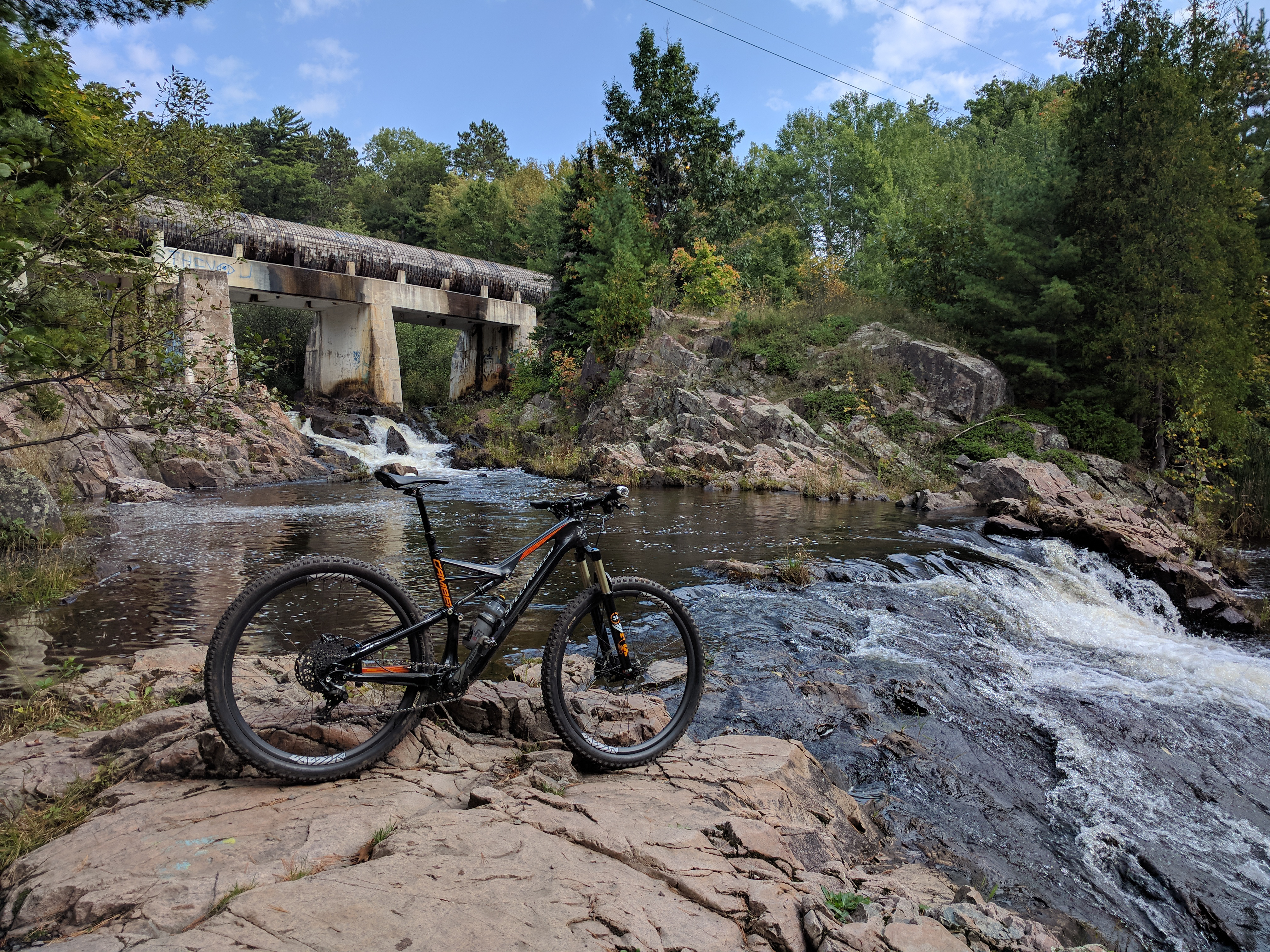
As you explore be sure to ride under the penstock itself; the large wooden pipe seen in countless MTB tourism videos (and above) and is a really neat experience. This can be done either when riding the BLP Rocks trail or at the east end of Blue Heron, just south of where it connects to The Penstock trail.

There are a number of small offshoot / casual trails along here, so watch for the main groove and stick to it. In some places the trail spiderwebs a bit, but don’t be afraid of getting lost. It’s a pretty easy area to understand, and most of the trail is fairly close to roads. Periodically you’ll encounter the Noquemanon Trail, an XC ski trail that’s open to bikes between the Forestville Trailhead and the Tourist Park Trailhead. It can be a bit sandy on the west end, but towards the east it’s quite beautiful, passing by ROTC Rock.

By heading east on the North Country Trail from the trailhead (blue rectangular blazes) one can get quite close to Lake Superior and connect to the bike path into Presque Isle or town.

The North Trails are extremely popular with runners and dog walkers, so keep an eye out for other users, particularly in late morning or after work.

RAMBA Trails

Overview: Mostly located in the space between Ishpeming and Negaunee, about 20 minutes west of Marquette, built and maintained by the Range Mountain Bike Club (RAMBA Facebook Page).

Where To Start: These are a collection of hand-built, rugged trails. Maps of some trails are available via Trail Genius, Trailforks, or in print at shops. This area is a spiderweb of trails that is now pretty well signed signed, but at times it can be a little confusing to navigate. I suggest starting at The HOB — the official RAMBA trailhead — which can be found either by following the RAMBA Trailhead signage off of US-41, or by navigating to here. There are also official trailheads at Jackson Mine Park in Negaunee or off of the Iron Ore Heritage Trail (IOHT) in Ishpeming at Cognition Brewing Company, but the signage is easiest to follow from The HOB.

For a hefty, but fun, ride seeing typical Ishpeming area trails, I suggest riding the Epic Loop. Plan on three hours for this ~18 mile loop, but expect some seriously wonderful views and fun climbing and descending amazing hand-built rocky stuff. This is a much harder ride than anything recommended above in the Marquette area, but it’s fun and a nice variant on UP riding.

After finishing, detour over to Jasper Knob — the world’s largest exposed gemstone — that offers a wonderful view of the Ishpeming and Negaunee area including the Tilden Mine tailing piles. Make your way to Jasper and Hill Streets (map), and on the north side of Jasper St. there’s a small wall with a stairway built in. Go through the stairway and follow the path up the hill to the top. (Yes, it’s ridable the whole way up and down.)

On Wednesday evenings there is a group ride which meets at Cognition in Ishpeming and leaves at 6:30 pm during the summer, moving back to 6:00 pm as the year moves on. (Check the RAMBA Facebook group for details.) At these rides there are groups which range from extremely fast locals who intimately know the trails to more casual riders who will head out for a stroll on the two track. Introduce yourself, ask around, and find a group that seems right to ride with. Don’t be intimidated; folks on this ride are super friendly and it’s an excellent way to see the RAMBA trails and meet up with some great people. And after, grab a pizza-to-go from Congress and eat it at Cognition. Mmm!

RAMBA trails to range from fast and fun to rocky and challenging, with a number of sections that are currently way beyond my skill level. Each time I’ve gone to ride here alone I’ve become a bit lost and frustrated that I couldn’t find trails I’d been on in the past, but still had a good time. One of my favorite parts is riding through the Negaunee Caving Grounds / Old Town Negaunee, a portion of the town which was literally undermined and closed down. Trails run along the old streets, sidewalks, and stairways which are now a park.

Harlow Lake

Overview: Trails located in and around Harlow Lake and the Little Presque Isle Cabins.

Where To Start: Home to some of the more photogenic and technical trails in the area, Harlow Lake is often touted as some of the most rugged riding in the Marquette area. This area contains everything from the infamous wall ride featured in Jeff Lenosky’s Awesome riding in the UP of Michigan video to Bareback as seen in Travel Marquette’s 4 Trails 2 Minutes video.

Since becoming officially recognized by the Michigan DNR there have been wayfinding signs installed, and an official map is now available (link). It’s not as well marked as either the NTN North or South Trails, but there are now signs at each official trail and maps located throughout the property. It’s now pretty easy to find your way around without a guide.

There’s some incredibly scenic trails here, but they are seriously rugged, and I’d caution a new rider from downstate about riding here without a bit of preparation. Bring a copy of the map as cell phone service is spotty. This area is fairly remote, you’re unlikely to encounter others, let someone know where you’re going to be at. Bring some offline maps via OsmAnd+ and/or Trailforks, ride cautiously, and be ready to do a bit of exploring. But also be ready to have your jaw drop at the scenery.

Riding in the Marquette area is great, because it’s usually possible to safely ride from wherever you are staying to the trails. In Marquette itself there are rail trails, multi-use paths, and safe residential streets that connect almost everything. One can even get to the RAMBA Trails from Marquette via the IOHT and up into Harlow Lake via dirt roads that connect into the SBR (off of the North Trails). When I’m staying in the area I’ll typically ride from wherever I’m at to the trails. It’s a great way to see the town and warm up one’s legs before getting to the single track.

After a day of riding you’ll want food and beer. Here’s a post I did in mid-2015 covering good places to eat in Marquette: Marquette Food Recommendations.

Finally, the great trails in the Marquette area are mostly built and maintained by volunteers, with the NTN having a small paid staff of trail builders and groomers. Sign up for a Noquemanon Trail Network Single Track membership (I’m at the $50 level myself, which seems good for an out-of-towner) and give a bit back to the trails you enjoyed. Support RAMBA by clicking the Donate button at the bottom of their page and tossing them some money as well.

Leave a Comment

Marquette Food Recommendations

After traveling to Marquette a handful of times I began putting together a short list of restaurants and such which I think are worth eating at. This started as a list that my friend Marty sent, but I’ve built it out and added my own descriptions. This was sent to a few friends who are heading to this part of the UP for the first time and now I’m wanting to share it as a blog post.

Just because something isn’t here doesn’t mean that it’s bad; I simply haven’t tried it thus don’t have anything to say about it. Every place listed here I’d gladly eat at again:

Donckers: Candy shop, has a restaurant upstairs that’s great for breakfast. I haven’t had any other meal here.
Sweet Water Café: I like this place more than Donckers for breakfast, but it’s different. Donckers is more like a high quality greasy spoon; Sweet Water Cafe is more like an Ann Arbor restaurant with high quality ingredients. Both are good.
Lagniappe: Cajun place. The food seemed good, but prices struck me as a bit high. Tasty, though.
Vango’s: Pizza place which is outstanding, the cudighi (local style sausage) sandwich is great.
The Vierling: Little more upscale restaurant and brewery, but t-shirt/jeans is still fine. Good food, more sit down-y.
Border Grill: Tex-Mex short order stuff, really good. The fish tacos were some of the best I’ve had.
ToGo’s: Good sandwich / sub shop; great for carryout.
Jean Kay’s Pasties: Classic UP pasties, really really tasty. You can also buy them par-baked / frozen to take home.
Ore Dock Brewing Company: Good brewery, snacky food (not much). You can bring food in.
Blackrocks Brewery: Great brewery, no food at all. I think you can bring food in.
Third Street Bagel: Giant bagel sandwiches, decent coffee. Open early.
Dead River Coffee: Outstanding small coffee shop. Very, very good.
Marquette Food Co-Op: Great little grocery store, prepared food, real high quality stuff.
Tadych’s Econo Foods: Regular grocery store, great beer selection. Essentially across the street from the north end of the black trail (Harlow Farms Connector) or whatever; the easy way into the trails from town.
Jasper Ridge Brewery: This place is in Ishpeming and where a group ride meets at 6pm on Wednesdays to ride the RAMBA trails. Beer is nothing special, food is basic. The deep fried mushrooms are great.
Muldoons Pasties: This pasty shop is located in Munising, about an hour from Marquette. Pasties are tasty, but different from Jean Kay’s. I think I like Jean Kay’s more, but a pasty from Muldoons is definitely good and hits the spot.
Steinhaus / Steinhaus Market: Two locations, same people. Really good German-style food. Outstanding for breakfast or dinner. Just simply outstanding. Do not miss.

Leave a Comment

Manistee / Cadillac / Ludington Area Fat Bike Suggestions

A few months back I happened across this page on fat-bike.com about Ken Blakey-Shell and Scott Quiring riding part of the Little O ATV Trail on fat bikes and wanted to try it myself (Video 1 · Video 2). A mutual friend put me in touch with Ken, and within a few days I’d received a boatload of excellent information about where to ride in the area. Ken encouraged me to share the info, so I’m posting it here for public consumption. While I haven’t ridden any of these trails yet myself, the routes sound excellent and something I hope to do in mid-June.

I’m really excited about riding these. Back-country rides like this are something I love, and new trails to explore sound wonderful.


Here are the suggested routes as Ken emailed them to me. I’ve edited these slightly add links, GPX copies of routes, etc, but it’s otherwise his words:

Little O ORV Trail / North Country Trail

The Little O ORV Trail (PDF Map) / North Country Trail (NCT) figure 8 just north of M10 is the easiest and least technical. It is 50% NCT and 50% moto trail with a around half of the moto trail being super good and the other half of it being only ok. The moto trails are fairly sandy and are best on a 4″ tire fat bike setup although 29+ and 26×5″ work OK too. Regular MTB is a no go. The moto trails are wider (4 wheelers use them too) with lots of banked corners and whoops. There are some extended downhills that are super fun. The other half of the ride is on NCT which is awesome in its own right. There is some significant climbs on this loop but it is all pretty gradual and none of the downhills are very sketchy. I normally start and finish on the northern end of the 8 but you could just as easily start at Timber Creek on M10 and ride NCT a little ways to connect up with the figure 8 loop.

  • This is the shortest route cutting out part of the upper 8. If pressed for time, fitness… this gets all the best parts: Strava · GPX
  • Strava link for just the figure 8: Strava · GPX
  • Strava link for the figure 8 plus some extra NCT starting and finishing just north of the Sable River: Strava · GPX
  • You can also start from the NCT Freesoil Trailhead on 8 Mile Rd but that makes for a fairly long ride: Strava · GPX

North and South Caberfae Loop

The other two routes I recommend are between Manistee and Cadillac. One route is north of M55 and the other is south of M55 and both start at the Caberfae Snowmobile Trailhead. Both routes are a combo of moto trail and two tracks. The moto trail is a lot more technical than anything I have seen for MTB trail in the LP  – I often describe them as the most non-IMBA approved trails in the world. They go straight up and down hills, have tons of water erosion caused trenching, exposed roots and rocks and are really challenging on both the up hills and down hills. There are tons and tons of whoops and bermed corners. Unlike the Little O which is a wider 2 track type trail, these trails are tight singletrack. Quiring and I find these trails to be the most fun of any trails we have ridden in the state but you have to like a challenge to fall in that camp. 29+ is the ideal setup but 4 or 5″ fat bikes work great too. You may be able to ride a regular MTB but it would be tough. You can combine the two loops if you want into a monster ride but you need to be in top shape (both upper body as well as normal riding shape) because you are going to get worked. Both loops are equally good so it is a coin toss which to do. I normally break people in on the north loop first because you start out on one of the best downhills around as soon as you start riding the ORV trail.


Maps

Here’s some heavily annotated map snippets that Ken has graciously provided. The base image for these comes from the National Geographic’s Trails Illustrated maps of the Manistee National Forest: 758 Manisteee National Forest, North Trail Map and 759 Manistee National Forest, South Trail Map. I strongly suggest buying the base maps, as the additional context is necessary to find your way to the trails and for understanding the area. These maps appear to be a great compilation of road, ORV trail, and North Country Trail maps all in one. No other map that I’ve seen as clearly shows how they all overlay; something which is incredibly useful for hikers and mountain bikers alike:

Leave a Comment

Marquette, MI

With two weeks off of work I took some time to head up to Marquette, MI for some mountain biking focused around the Noquemanon (NTN) Trail Network. Thanks to suggestions from my friends Nick and Marty Shue it was very easy to find my way around and I had a great time and I’m looking forward to my next trip there.

Here’s a dump of my thoughts consolidating information.

Lodging / Location

I stayed at the Ramada in downtown Marquette. Location for this was excellent, with a couple mile easy bike ride (via safety paths / non-road bike/foot specific trails) to both the North and South trail areas. These same trails extend for miles outside of town and would make for good road riding as well. I stayed in room 106, which was a single queen size bed located quite close to an outside door. This was very convenient for riding to and from the hotel. The room itself was nice, although it felt a bit damp in there and gloves/clothes took quite a while to dry.

The Hampton Inn location would also be good location-wise, but it’s quite a bit pricier than the Ramada.

Local Bike Shop

Upon arriving in town I stopped by Sports Rack, located about a block from the Ramada, to purchase an up-to-date trail map and get suggestions for riding. The folks here were extremely friendly, sold maps with all monies to benefit the NTN, and just seemed like a great shop. I didn’t need to buy anything from them, but if the need had arisen I would have gone here immediately. Definitely seemed like a great shop for summer and winter riding.

Food

The following restaurants were recommended to me by Marty, along with my thoughts on each. I would gladly eat at any of these again next time I’m in Marquette:

  • The Vierling: Little more upscale, but still casual and friendly. I had the whitefish with pasta, which was good, but the pasta was kinda lump-ish and together, which might have been caused by all the cheese. Still tasted good, though. Beer was good, even though when walking by the brewery one evening I saw an employee smoking while working in the brewing area.
  • Jean Kay’s: Seems to be proper pasties, nicely located between the North Trails and downtown not far from the bike paths. Good outdoor seating and deck for keeping an unlocked bike. Very tasty, not too heavy, great after a few hours of riding.
  • Donkers’ Restaurant: Candy shop / restaurant with good breakfast. Hash browns seemed a bit oily and I was disappointed that the sausage patty on one of the breakfast sandwiches seemed to just be a typical patty instead of something locally made, but it was still good. I had breakfast here twice.
  • Vangos Pizza: Bar that serves excellent pizza. Ate a small (one size up from a For One) with pepperoni, mushroom, and their house made sausage. Surprisingly good crust. Easy walk from Blackrocks as well.
  • Dead River Coffee: Really tasty coffee. I had a cappuccino while reading All my friends are dead.. I was there early enough in the morning that it was just myself and some employees so I felt a bit out of place (they were deeply discussing coffee roasting quality control techniques and whatnot), but not uncomfortable. This seems like a proper small coffee shop with people who really care about making good coffee.
  • Blackrocks Brewery: Probably my favorite of the local breweries. Great beer, really comfy atmosphere. Lots of bikes locked up outside. Bring food from elsewhere, though. Built in an old house.
  • Ore Dock Brewing Company: Another big name local brewery. Great beer as well, but didn’t feel as comfortable to me, perhaps because it’s more of a large hall-type building. Has pretzels (hot and cold) and popcorn for food, but also allows outside food.
  • Third Street Bagel: Bagel / sandwich place. Ate a breakfast bagel from here which I’d first purchased intending to eat while driving, but after seeing its size I ate it sitting outside the restaurant. Also has good coffee. Both were quite tasty and made for a pretty quick breakfast.
  • Togo’s: Sub/sandwich place. On recommendation of an employee I had the hot pastrami sub with mustard and horseradish. This was a good choice; ate it at Ore Dock Brewing Company.

Trail Routes and Difficulty

To start, the maps on the NTN website are not as up to date as the one which can be purchased at the local shops. Additionally, the purchasable map does not include the 1-2-3 portion of the Harlow Farms Connector Trail which is incredibly useful for accessing the south trails from the Iron Ore Heritage Trail (rail trail / non-motorized path) which runs through downtown and within a couple hundred feet of the Ramada. Signs like this lead the way. Still, this was quite easy to find when actually riding, and both of the main Marquette systems were close enough to downtown that I didn’t regret riding to the trails each day.

Once on the trails, though, the marking is outstanding. I almost never had a problem figuring out where I was on the South Trails, and only a couple parts of the North Trails (in particular in The Cedars section where the trails is very close to the Noquemanon Trail and there are a spiderweb of connectors) where I got a little confused, but I wasn’t lost — I just wasn’t sure if I was on the right trail. It was still loads of fun, though.

Anxious to get out and ride, on my first day of riding I found myself on a black diamond trail, and this is where I had my first fall. I was trying to ride up some rocks, got my wheel stuck, and just toppled over. I slid a bit, but wasn’t hurt and was more amused than anything else. This photo shows where I fell, which in retrospect (and after riding other trails there) was really quite an easy spot. I think I may have been arrogantly pushing a bit that first day.

What I learned was that the trail designations are pretty spot on to the IMBA descriptions. Black diamond is about my upper limit, and these seem to either be because of exposure (steep drop-offs) or technical challenges, or a mix of both.  I can deal with both by walking, but my slight fear of heights makes it harder to deal with the exposure. On my last day of riding in Marquette I found myself on a trail called Gorge-ous which had enough exposure in spots to nearly induce a panic attack in me. It’s beautiful, but it snakes its way down the edge of a gorge up above the Carp River, and the drop-off would cause some serious problems. This photo shows one of the more exposed spots, complete with a repurposed truck mirror to allow riders to see around the corners (these are two way trails, remember).

I mostly enjoyed the blue square (intermediate) trails, as there was pretty much nothing on these I couldn’t ride comfortably. They were nice for just rolling around and seeing how beautiful the area is. When I’m up in Marquette the next time I’ll likely try out more of the black diamond stuff, but after being a bit thrown off by a technically difficult group ride on Wednesday evening I was playing it safe.

Group Ride

The folks at Sports Rack told me about a group ride at Al Quaal Recreation Area in Ishpeming on Wednesday nights at 6:30pm. Wanting to see some new trails I headed out for that. This ride apparently breaks into three groups (A, B, and C), and I made a mistake when I chose the A group. If/when I go back I’ll likely ride with the B group.

I’d heard that the A group was fast, and that Al Quaal was mostly XC ski trails with small amounts of single track. I’d also heard in the parking lot that the single track is about as difficult as the Blue loop at Marquette South, which sounded fine to me. I could ride hard on the wider stuff, then deal with the single track. This turned out to not be the case, the trails were some of the most technical and rocky that I’ve ever personally been on and I was in way over my head. There were numerous 8″ – 12″ rocky step-ups and climbs far beyond what I’ve ever ridden before and thus I walked quite a bit. For the part I rode there was actually very little XC ski trail, even though the climbs and downhills on it were quite fast and fun.

This held the group up a great deal, so after making my way through a bit of it I was going to head back early. Very kindly of them the group didn’t want to let me head off alone somewhere I hadn’t been before (even though I knew I could find my way back) so I kept on a bit further, before splitting off and heading back to the cars with someone who was cutting out early named Don. After this the group carried on to some other trails which apparently have considerably more exposure, including rocky ledges looking down at the tops of trees. I’m glad I didn’t carry on to this area.

(This technical loop seems to be partially labeled with pink signs indicating the Quaal Loop. It does not yet seem to be mapped.)

Later that evening I ran into two of the B group riders at Blackrocks who I had previously talked to in the lot, and that conversation confirmed that I was in over my head. It sounds like the B group would have been much more my thing… More XC ski trails, more single track but not things as hard as what the A group did. Whoops.

I just hope I didn’t squish the group’s plans too much. I definitely learned something that day, though.

Routes Ridden

In the three riding days in the Marquette area here’s where I went, as illustrated via Strava:

After Marquette…

After leaving Marquette I headed down to Glacial Hills in Bellaire. I’d heard of this trail for a couple years, and finally having the chance to ride it I wish I’d gone there sooner. This is incredibly flowing, quite easy (but fun) machine-built trail. I was amused that it was about the same difficulty as the Grom (Beginner / Kids) Loop in Marquette, but for almost 30 miles. It was a blast. (Strava data.)

Once I was done riding at Glacial Hills (mostly because the sun was setting) I headed to Traverse City and checked into a hotel, staying the night so I could attend an Iceman Out-and-Back ride put on by Einstein Cycles. This was a not-fast-paced-but fun ride from the shop out to Kalkaska, then back via most of the Iceman route. Due to pacing, stops to chat, and getting turned around on some of the newly cut trail segments we didn’t have time to do the full route, but it was still a good time. It was nice to spend some time in the northern Lower Peninsula riding as well; which is completely different from what’s found near home, and different still from Marquette. (Strava data.)

Photos

Photos from this trip to Marquette, including a couple along the drive and riding to and from there, can be found here.

1 Comment

Back Roads…

Quite a while ago now, back when I was 17-18-whatever, not long after after graduating from High School, I spent a lot of time just driving around randomly with friends, listening to music, poking around random dirt roads and interesting areas doing little other than driving around and talking; essentially hanging out in a car.

I now realize that many of these areas where we ended up are the northern Oakland County dirt roads where I’ve found myself riding bicycles with friends. I’m really happy with the way life has turned out and thus while I recognize that such days-gone-by were great, I don’t particularly want them back. They were good, but are best left as memories to be reflected on while enjoying the now.

(Photo above is Jered and Wendi from thus autumn when we rode an extended version of the Flying Rhinos Back 40 Challenge on some of the aforementioned dirt roads. It started a bit cool, but was otherwise a great weather day.)

Leave a Comment

Thoughts on Interbike by Invitation

Having vacation time to use up I decided that heading out to Interbike would be pretty nifty. I didn’t have time to set things up for attending as a proper attendee (one day I would like to go representing CRAMBA-IMBA to get us more sponsors/donors), but Mike Flack at Trails-Edge was able to get me on the Interbike by Invitation program.

This new program allows invited consumers to attend the last day of Interbike as a VIP and receive a gift bag on registration, for a $50 fee. This seemed reasonable to me, so I booked a trip to Las Vegas.

On my first night in town, Wednesday, I planned to attend CrossVegas, which was recommended by both the Interbike site and CX-fan friends. This is where I hit the first wrinkle: Interbike passes were required to board the shuttle to the race site, but by Invitation people couldn’t pick up their passes until the following morning. I ended up taking a $40 cab ride out to the venue and was able to just board a shuttle back without showing a badge, so everything worked out. But, it was a bit frustrating to not be able to use the outbound shuttle.

The CrossVegas race itself was great. A full writeup on the race can be found here at Cyclocross Magazine, and the venue is a great bowl-shaped grassy area with great visibility. There was also plenty of reasonably priced beer and burritos (from Qdoba, but still decent) available. I’d love to attend races like this more often.

When collecting my ticket for CrossVegas I received an interesting coupon: offering my admission to Interbike on Friday, the same day I was already limited to via by Invitation, for $25. This is half the price of the way by which I’d registered, and didn’t involve receiving a bag of goodies, but upon receiving mine the following day I found it to not be worth the $25 up charge. My bag included a poster, long-form uber-stylish cycling magazine, cooling band, size small T-shirt, and some sample self-adhesive reflectors. I feel bad and wasteful saying this, but it is mostly stuff that I’ll toss out because it is completely not useful to me.

The following evening was the USA CRITS final in a parking lot of Mandalay Bay, the venue for Interbike. This was a pretty fun and exciting race as well, but due to the onsite food being handled by the resort it was a good deal more expensive ($6.50 for what seemed like a 12oz cup vs $5 for 16-20oz at CrossVegas), and I suspect this contributed to the more mellow crowd. I’d never seen a crit before, so it was pretty exciting to see pros holding ~27MPH for 1.5 hours around a twisty, metal-edged 1km course.

After getting a good night sleep I woke this morning, excited to attend Interview and see what the show was like. Overall this was a really good time, but I was actually a bit let down as many of the brands that I hoped to check out weren’t present. Of QBP‘s family only Surly was there, which disappointed me as I really wanted to see All-City who, per this blog post, chose to skip the show citing strong sales. Salsa also wasn’t there; maybe they are doing so well that they don’t need to be touting their wares at a B2B show.

There also seemed to be a strong standoffish feeling from many vendors, which I can’t help but think from our notably different …by Invitation badges. While I can’t really fault internal sales folks for being apprehensive about talking to the general public, it seemed as if some of the brand reps didn’t want to say much. Then again, it was nearing the end of the last day of what’s probably their most hectic week of the year.

It was also pretty clear that the brands people were dancing around their normal show sales, with tape covering (or changing to MSRP) prices for show specials and others just saying that the product (even those which aren’t shipping yet or were special Interbike versions) are available at your local bike shop. This is good for the shops in general, but always came after some awkward checking of ID tags. A couple vendors offered me their products on a deal anyway, and while I’d love to have tried the two, I didn’t really need them and they would have been awkward to carry. I probably could have snagged some cheap carbon rims or a frame from one of the Chinese vendors as well, but again… no need.

I did get to see some pretty interesting folks as well. For some reason I kept crossing paths with Jeff Jones, and saw Kirk Pacenti,
Ron from King Cage, and a very business-looking guy with the last name off Thomson in the Thomson booth. I also got to meet and shake hands with Stan of Stan’s NoTubes while talking to him about his prototype fatbike tubeless rim. (He kept having to stop and ask people — including me — not to look inside because it is the very first prototype and still has some very secret details. He seemed quite proud of it, though, and holding it with a deflated tire soundly seated I’m apt to believe his claims.)

So all said, I think it was a good trip thus far, and if the Emerald Expositions folks can sort out the … by Invitation quirks I think they’ll have a good option for the general public. I think for me I won’t want to come back unless it is as a full attendee, hopefully with a bit of business to do as well.

Leave a Comment

Jamis Nova + CrateWorks Pro XL-C

I’d previously had plans to ship a bicycle out to California for a trip visiting friends, but ended up cancelling this part after beginning to pack my bike. A buddy of mine, Tom Lining, was nice enough to let me borrow the CrateWorks Pro XL-C box which he used on a recent trip to Germany for Bike 4 Peaks. This would have worked out rather well, but mid-packing I came to the realization that my trip will likely be much less stressful if I don’t bring a bike.

While it’d be nice to have a bike out in San Francisco and people to ride with, these downsides felt overwhelming and kept me from wanting to bring it.

  • Packing the bike: If I do this wrong, it’ll get damaged, either outbound or inbound.
  • Unpacking the bike: I’d really prefer to have my full suite of tools for bike assembly. Without this I’ll have to make do with a multitool and whatever I pack.
  • Clothes: I’ll also have to fit in bike clothes, shoes, helmet, gloves, glasses, bottles, etc.
  • The City: I’m not at all familiar with road riding, much less in an urban area. If I wasn’t certain to have someone to ride with I’d be very apprehensive about going out myself.
  • Routes: I don’t know any good cycling routes in the area, and it’d be very complicated to find some if I can’t find people to ride with. Thus, my desire for lengthier (2-4 hour) rides each day would likely not be met.
  • Insurance: Should something go wrong, do I really want to have to deal with insurance and prove that I didn’t screw up? And what if I did?

Shipping via BikeFlights.com was quoted at a very reasonable $170-ish (round trip) with $3000 insurance, but that’s still $170 I don’t have to spend. I’d consider this same setup (a CrateWorks box + BikeFlights.com) again in the future should I need to ship a bike. It seems like a good setup, but for this trip… I think I’ll stick to walking / hiking, and maybe renting a bike for a short poke around the city.

Just simply coming to the decision that not bring a bike was for the best made me feel more relaxed. And that’s what vacations are about, right?

Leave a Comment