
A bit over two years ago I attempted to ride from near Addison Oaks up to I-69, but fell short due to the trail being washed out. Today, the first would-be-work-day of my current vacation, I decided to try again, this time starting from my house. Even though I had to cut it a bit short due to Roxie (photo gallery retired) becoming ill and didn’t make my desired 100 miles, I think the ride was a success.
The ride started out with me meeting a friend named R (he asked me not to mention his name because he was taking a much-needed break from work), and he and I made our way up to the Polly Ann Trail. At this point he turned west and began heading home, while I went northeast and continued on towards my destination. After crossing the Lapeer county line and weathering the rough, unkept (although occasionally mowed) trail I hit my goal, the Interstate 69 underpass just south of Lapeer. I carried on for a couple miles further north before turning back and beginning the ride home.
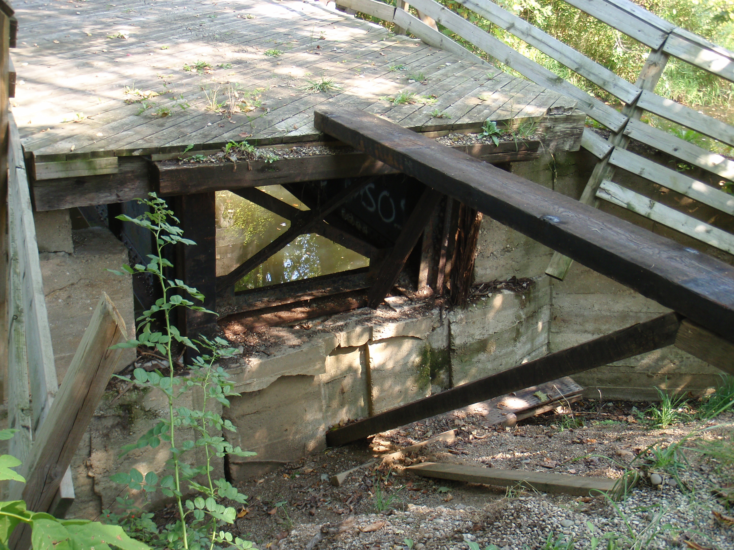
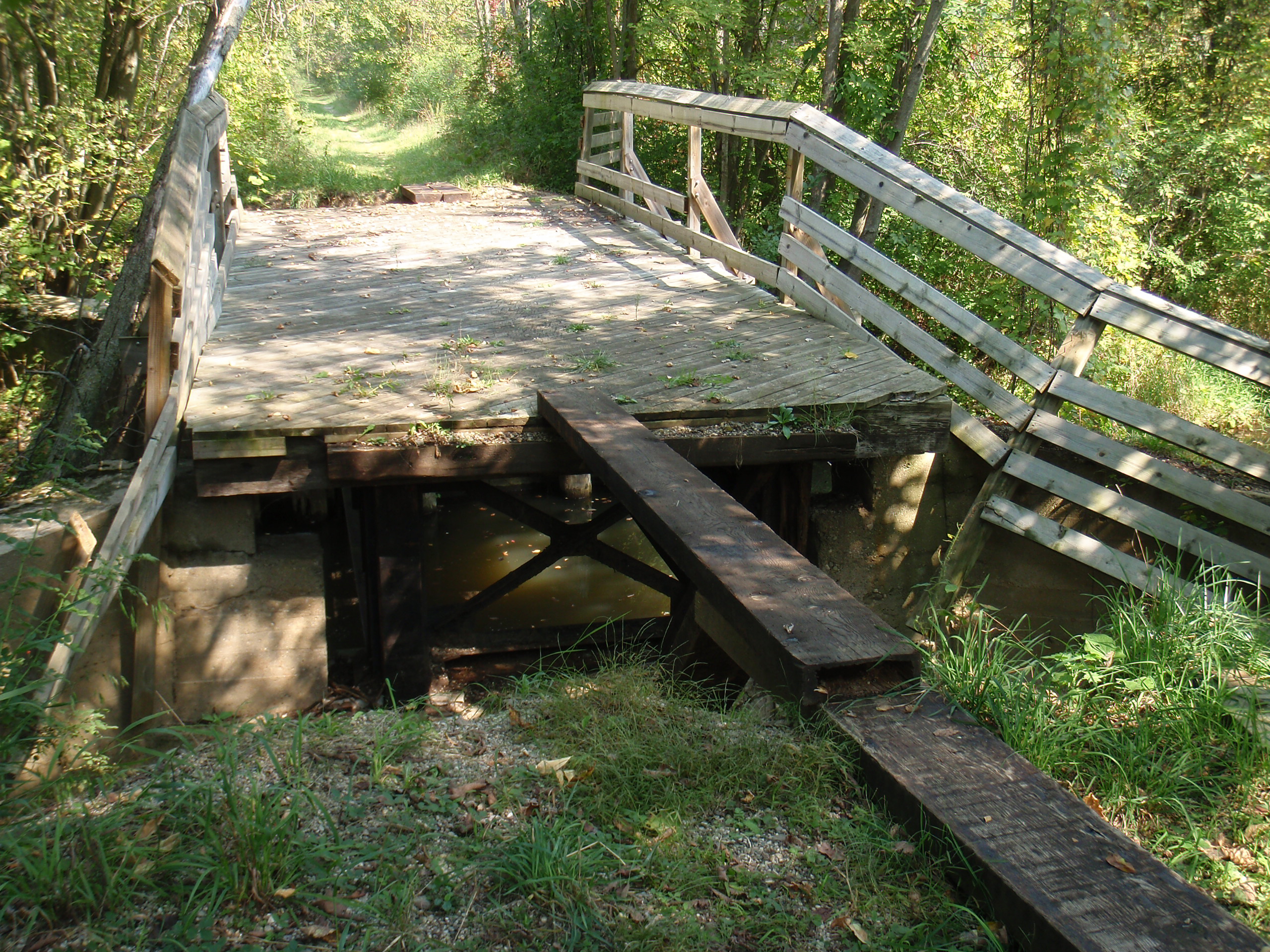
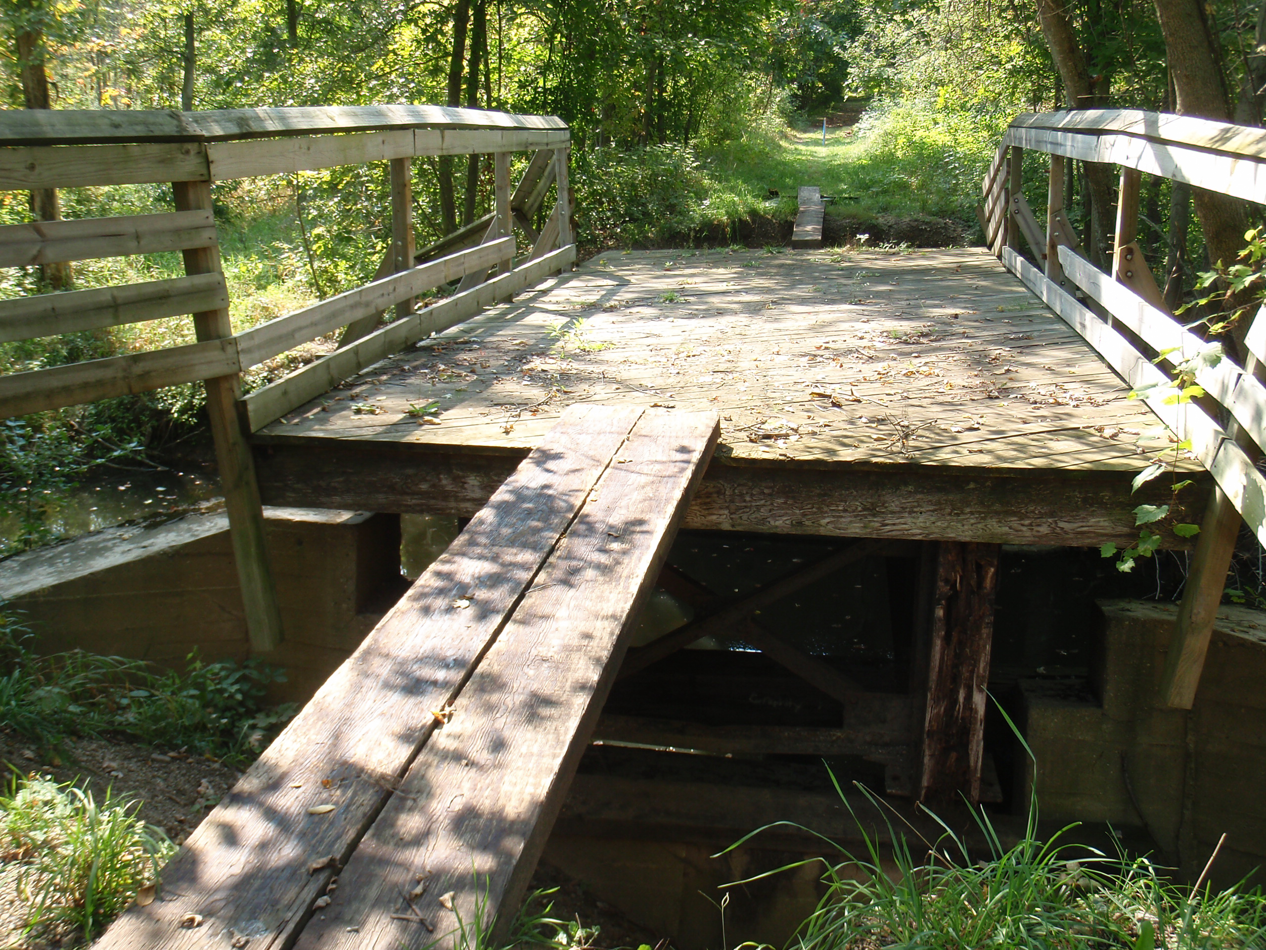
On the way out I’d had to cross a rather questionable bridge which washed out almost four years ago. Back in 2009 Erik, Kristi, and I happened across this bridge and turned back, but now some enterprising soul(s) had built a timber crossing so I was able to easily keep going. Despite a 10′ drop on to concrete and iron I used my bike as a balance beam and walked across the 10″ wide wood plank to get to the body of the bridge before crossing another two on the far side.
On the way back I’d intended to bypass this bridge via dirt roads, but a bit of a miscalculation resulted in my traversing it in the other direction. While stopping to take pictures I was surprised by Dustin rolling up, having chosen to take the same sort of ride as me today. After heading south via dirt roads and into Stony Creek to refill water and drink mix, and then decided to detour through The Pines before heading home, but while in there I came across someone who let me by then seemed to be looking for his friend Charles. I headed up ahead to let this person know that his friend is all right (but just a ways back), and realized it was Charles, brother of Mr. George Hotelling, who I’d met at a housewarming party this past winter. What an unexpected coincidence.
Then, on top of that, it turns out that a former coworker spotted R and I riding up Lake George, but didn’t catch up with us before we’d turned off the road.
Everything was going great until Danielle texted me while I was talking with Charles and his friend to let me know that Roxie wasn’t doing so well. She had been pooping paste for a couple days, and this afternoon Danielle contacted me to let me know that Roxie had begun vomiting and then wouldn’t get up off the lawn and come back inside. Worried she took Roxie to the vet, and I rushed home. I had another 20 miles in me and could have broken 100 today, but Roxie is more important than that. (It turns out that Roxie has a GI infection resulting in her having digestive issues and being lethargic. She’s on a diet of mild food and antibiotics for a few days, after which she’ll hopefully be better.)
All done, here are today’s stats and route map on Strava. This was a good ride, and I’m thinking that I’d like to do something similar before vacation is over; perhaps some time early next week.
Here are the four decent photos that I took today:
· Looking north along a washed out bridge on the Polly Ann Trail just south of I-69.
· Looking south along a washed out bridge on the Polly Ann Trail just south of I-69.
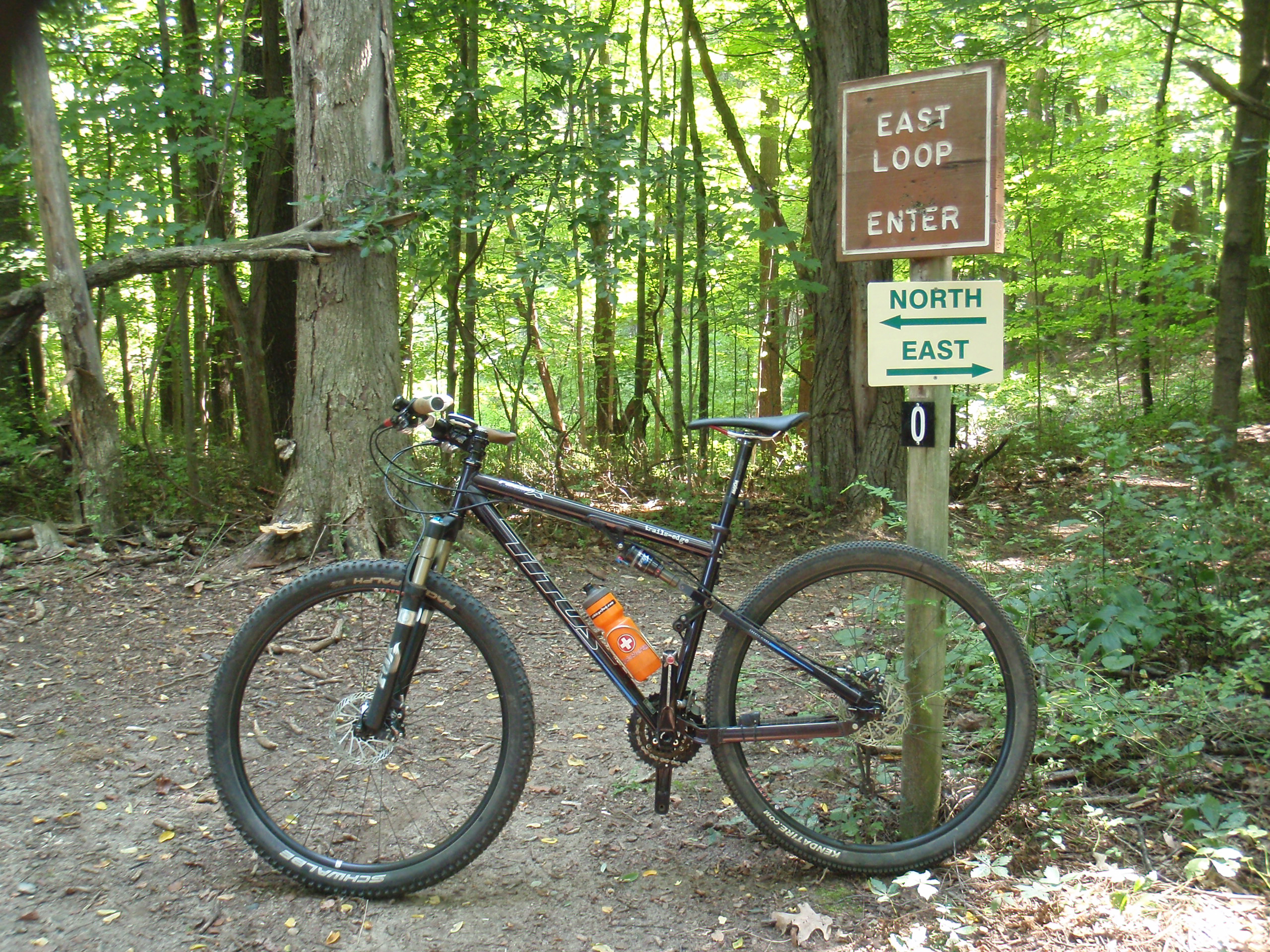
· The Titus on the Polly Ann Trail where it passes under I-69.
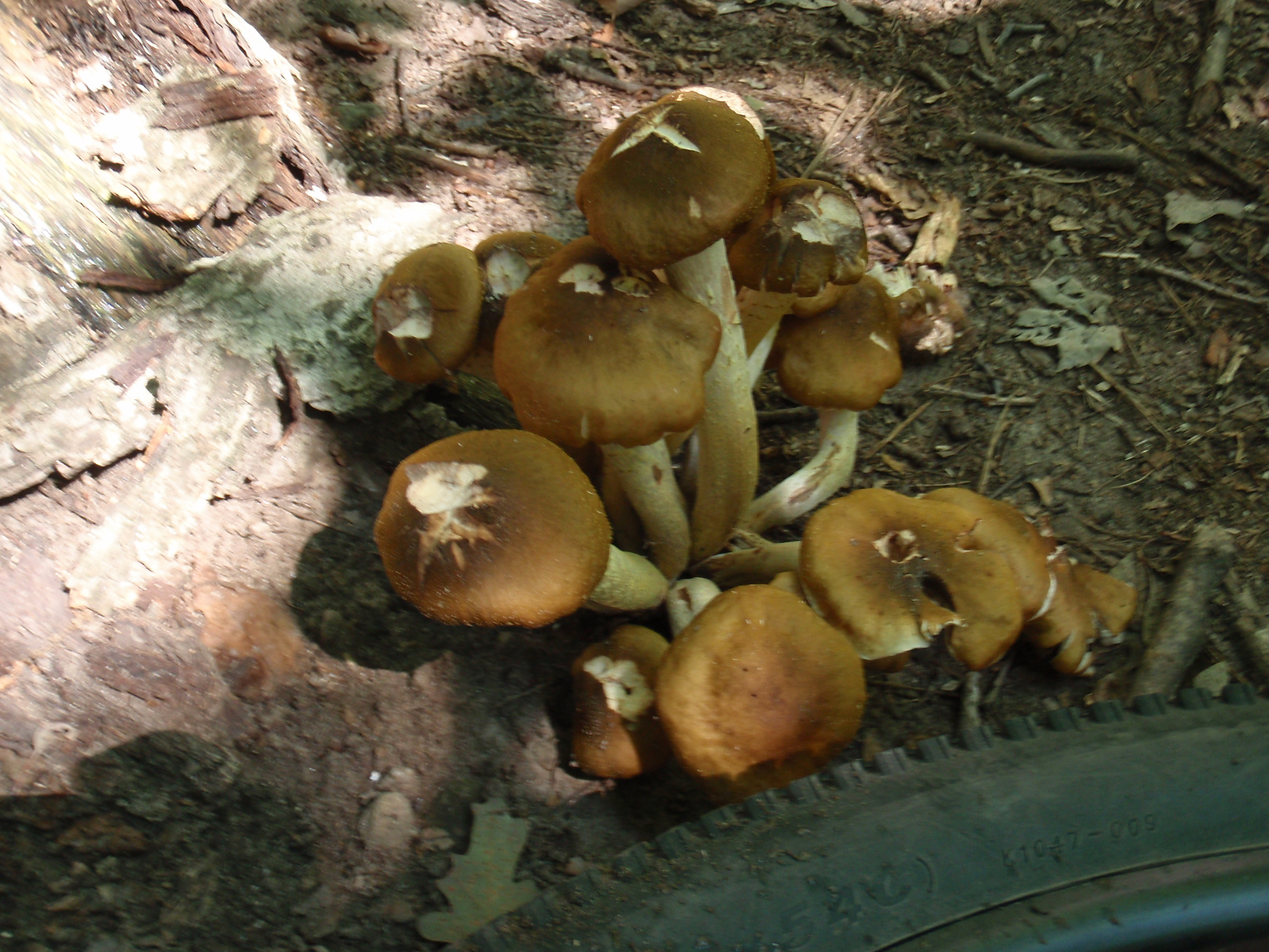
· Looking down at the board which I walked to access the washed out bridge along the Polly Ann Trail.


