ITRS, OSM, and trailmaps.app
Much earlier in the year, around the time I began the trailmaps.app revamp, I found out that some of the local trail systems may end up using the new International Trail Rating System (ITRS). This rating system wasn’t yet in OpenStreetMap (OSM), but wanting to incorporate every rating system that could be used on local maps, I reached out to Mischa and Edoardo if they had any plans to get it in there.
It turned out this was something they’d wanted to do, but kept running into small hurdles, and it had taken a bit of a back seat to other tasks. We emailed a bunch and met a few times, I offered to see if/how I could help, and after a few months of on-and-off work, everything lined up. OSM now supports ITRS tags, I’ve built a usable (but kinda proof-of-concept) tool for translating ITRS survey data into OSM, and I extended my maps to show the ratings.
And the first live map is a big one: Copper Harbor!
It’s not an official map — just another one of my best-efforts-from-public-data things — but I really do think it’s currently the best online map of mountain bike trails in the area. It’s what I’d want if I was riding there.
And now OSM contains the mtb:scale:itrs:exposure and mtb:scale:itrs:technical_difficulty tags, which are the primary user-facing attributes of the ITRS system and what’s shown in signs along the trails:
- Exposure: Consequence of a fall off of the trail.
- Technical Difficulty: How much technical skill is needed to ride that section of the trail.
When an ITRS Certified Professional uses their tools (a neat mobile app and measuring tools for surveying the trail itself) to rate a trail, the output is a GeoJSON file that details, among other things, the technical difficulty of a section, its maximum exposure, and individual specifically-exposed points along the way.
To help get this data into OSM I put together c0nsumer/itrs-to-osm. This takes the ITRS GeoJSON, finds a matching way in OSM, then splits up the way and applies the Exposure and Technical Difficulty tags as appropriate. It outputs an .osm file (JOSM format) which gets opened in JOSM, manually reviewed in conjunction with an HTML report, tweaked as needed, and the uploaded to OSM.
While it was at first a vague thought, and clearly not the only way to do it (more a proof-of-concept), a tool like this is extremely important for getting ITRS data into OSM. And for my purposes, it works.
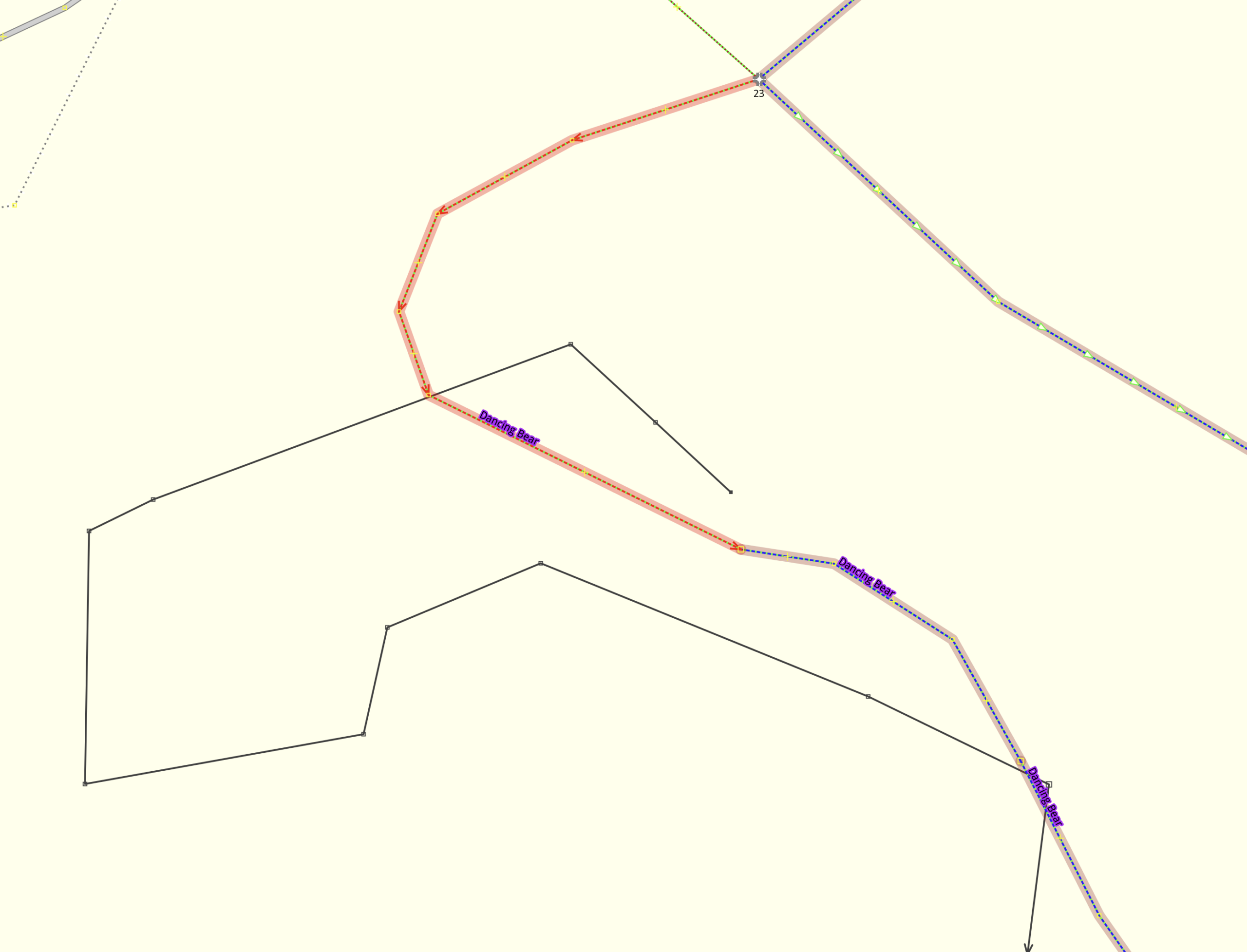
Specifically, when a trail is surveyed for ITRS, the GeoJSON has a new line in it showing where it recorded the trail as existing. OpenStreetMap already likely has a line (way) for this trail. Importing this directly would add a second line (duplicate data), or replacing the existing line would probably be less accurate, so this new data needed to get added to the existing route. This could either be done by opening the ITRS GeoJSON and visually matching, or making a tool that does it: that’s what itrs-to-osm is.
Wanting to be sure I avoided any automated (mechanical) edits, it intentionally requires the user to verify the changes made, which is done via both looking at the to-be-uploaded data in JOSM and reviewing an HTML-based report that shows what is being changed and why.
Nick, the amazing Trails Coordinator at Copper Harbor Trails Club (CHTC), has been surveying the trails for ITRS ratings. He and I have been working together with him sending his survey results and me using the with itrs-to-osm to get the data into OSM. Then with the work to add a new rendering style in the map generator and suddenly… It works!
This is a bit big of an example, but here’s the HTML report of an East Bluff merge I did yesterday: itrs-to-osm_eastbluff_2026-nov-21.html
In this file I merged eight survey files covering parts of Bermasaurus, Citrus Tech, Summer School, and Thunderbolt with the OSM data. It split up the OSM ways and applied the ITRS tags to the relevant sections. I manually checked things (sometimes if there’s too much GNSS recording drift it doesn’t match well and requires manual editing), did a little bit of tweaking, and uploaded it (changeset 192273800). Had this been purely manual retagging it would have been… a lot.
I’m really happy with this. My maps gained the ability to show another trail signage system used in Michigan, OSM gained a new tag for a trail system signing schema that’s growing across Europe and the US, and a usable proof-of-concept tool is now out there for bringing it all together.