Google Maps Street View: Detroit
December 11, 2007
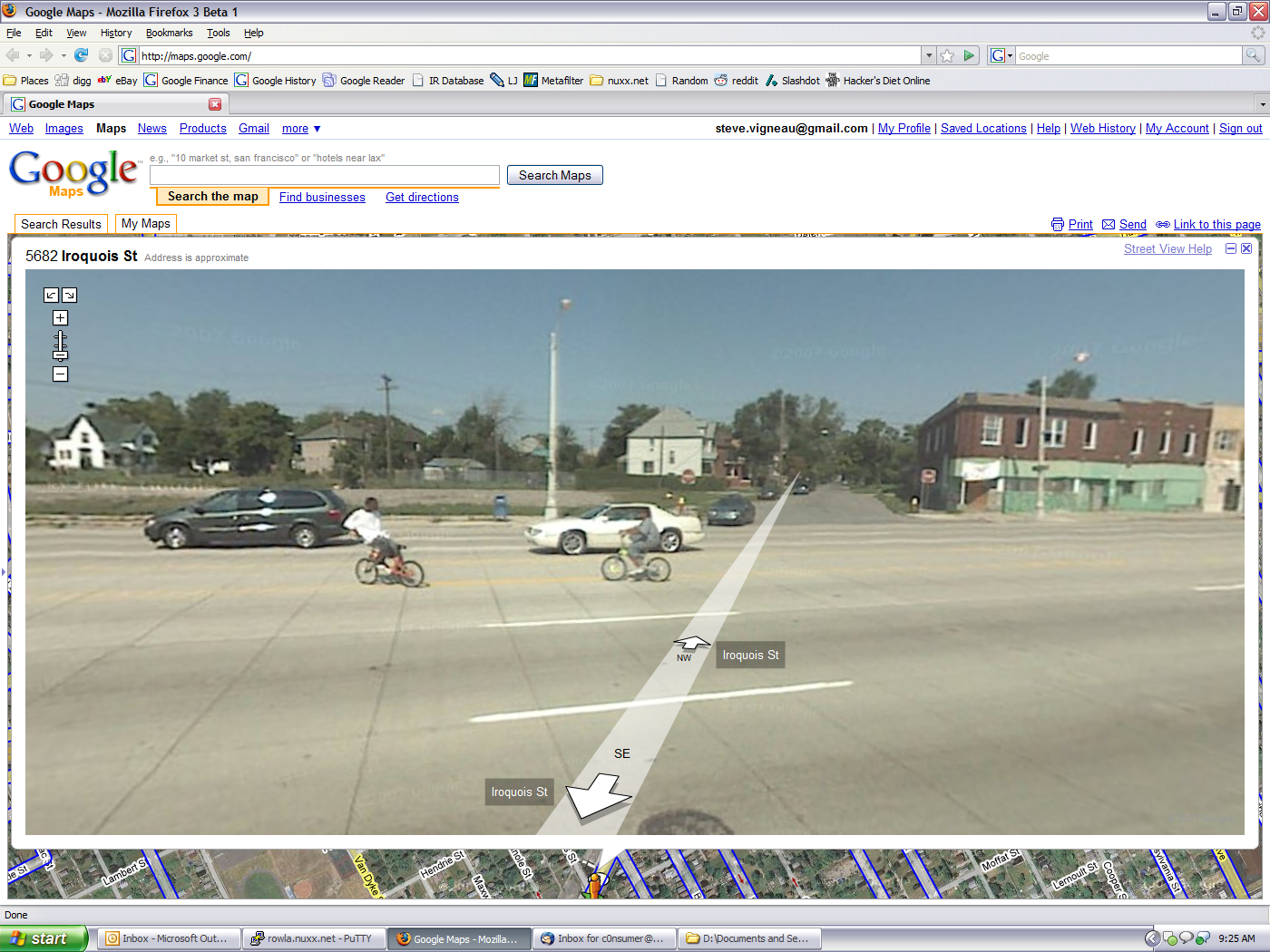
So, Google Maps Street View has gone live for Detroit and a bit of the west side.
Unsurprisingly, at the second random place I decided to look, the intersection of Gratiot and Iroquois, found random people riding bikes in the middle of Gratiot in the middle of the day.
Welcome to Detroit, eh?
Unfortunately it looks like The Heidelberg Project hasn’t been driven yet.
Hey at least on bikes, they usually get out of the way faster. We deal with so much jaystrolling to and from work every day it’s ridiculous. Apparently being a resident of Detroit includes the elimination of the color orange from one’s sight, because nobody can see the DON’T WALK flashing at intersections, and that’s if they cross at the intersection anyway. Usually they cross 10 feet south of it while oncoming traffic has a green light and they slowly stride across seven lanes of traffic, glaring and gesturing at any cars that dare to continue their legal travels down the road while they illegally and unsafely jaywalk, many times while holding small children.
But this is cool! They went just north of our work: http://maps.google.com/maps?f=q&hl=en&ie=UTF8&ll=37.09024,-95.712891&spn=47.167389,92.8125&z=4&om=1&layer=c&utm_campaign=en&utm_source=en-ha-na-us-google-svn&utm_medium=ha
That could be just about anywhere in Phoenix too :)
Check out 11 Mile in Oak Park between Coolidge and Greenfield.
It’s under major construction. :D So that will be the “look” of that stretch until Google gets around to changing it.