Over at Stony Creek Metropark, during the redevelopment of Shelden Trails (the “mountain bike trails”), the new route for the Roller Coaster took it up over a high point that came to be known as Fibber Mountain. While I originally intended this post to be an in-depth analysis of the knock-on effects of defining this name, that’s… just too much. So I’m going to leave this as a simple history of how the name came to be.
During the redevelopment of the single track, Loop C was to rebuild the Roller Coaster, as can be seen on the official plan (mirror) on pages 11-14 and 21. Part of this involved building trail up to a high point so some rock rolls/drops and a step-up could have a nice, gravity-assisted approach. This high point had some old trails leading to it — desire paths from hikers and some 90s-era fall line MTB routes — but was not in the official single track route and was more an old curiosity.
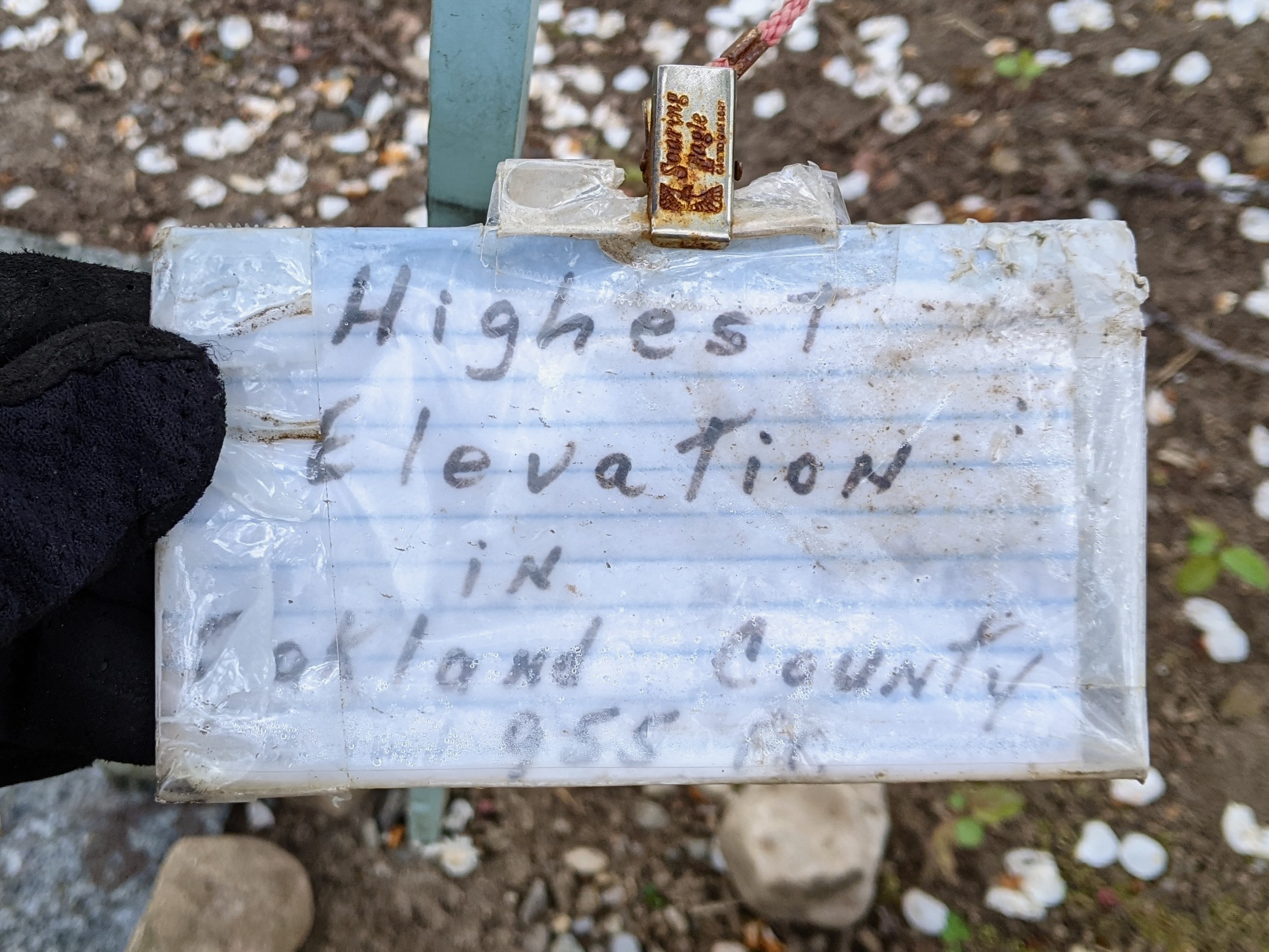
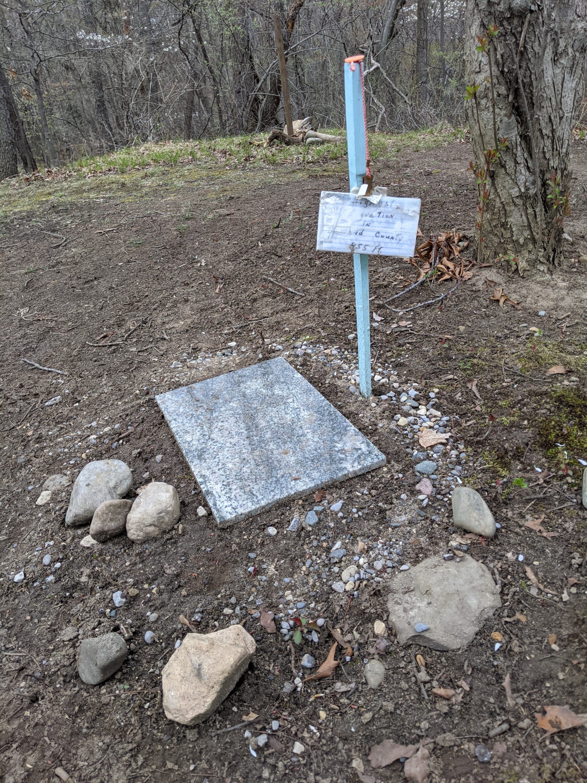
A unique feature it did have, besides the usual invasive growth, bonfire remnants, and empty beer cans, was a hand-made sign claiming that at 955 feet it is the highest point in Oakland County.
It was clear this wasn’t true as areas I regularly ride by, like the intersection of Drahner and Hosner (St. Benedict Monastery) logs at ~1150 feet on my bike computer, are higher and there’s a litany of information online about other high points in Oakland County (eg: 1, 2). But, like lots of little signs and hand-made monuments placed in the woods, it’s a neat bit of kitsch; something that’s best left in place as a trailside curiosity. And anyway, someone put time and care to making this spot special for them. It wasn’t harming anyone nor in the way of the trail, so we let it be.
Being directly adjacent to the single track, already cleared and a bit open, at the top of one of the tougher climbs, and just before some technical features, this location was inevitably going to become another hangout spot, similar to the Rest Area. So, it needed a name, but I didn’t really want anyone thinking this was the actual county high point.

When documenting the system updates in OSM I added this high point (natural=peak) and it became enshrined as node 8988989404. I initially gave it the name Liar’s Peak, but after talking with Kristen and her (very rightful) feeling that name seemed too negative, a couple weeks later I changed it to Fibber Mountain. This name was inspired by the They Might Be Giants song Fibber Island (video), with the goal of illustrating that the claims on the sign at the top were a bit exaggerated, while also being a bit silly.
The name trickled out and it’s now a great reference point. Trail users talk about the bypass for, or the rocks and jump and features after, Fibber Mountain. Widely used reference points like this are useful, and here we are with a new one.
The spread of this name outside the trail user community is what I didn’t expect.
For years there’s a been no end to the websites which scrape OSM and Wikipedia and whatnot to build content farms, but I really didn’t expect those farms to spread Fibber Mountain as far as they did. Now a simple web search for “fibber mountain” will turn up sites like AllTrails, Komoot, and PeakVisor competing to have the best info on “mountains” in Oakland County, the best trails near by, prompting to install their app for more info, etc.
It feels absurd that documenting and naming a local high point results in so much online cruft, but here we are. When originally thinking about this post I was planning to delve into the various Fibber Mountain websites, but the further I looked the more of a rabbit hole that became. And no one needs an analysis of the moving target which is auto-generated content. So I’ll leave it at that and, semi-jokingly, nod towards the Dead Internet Theory.